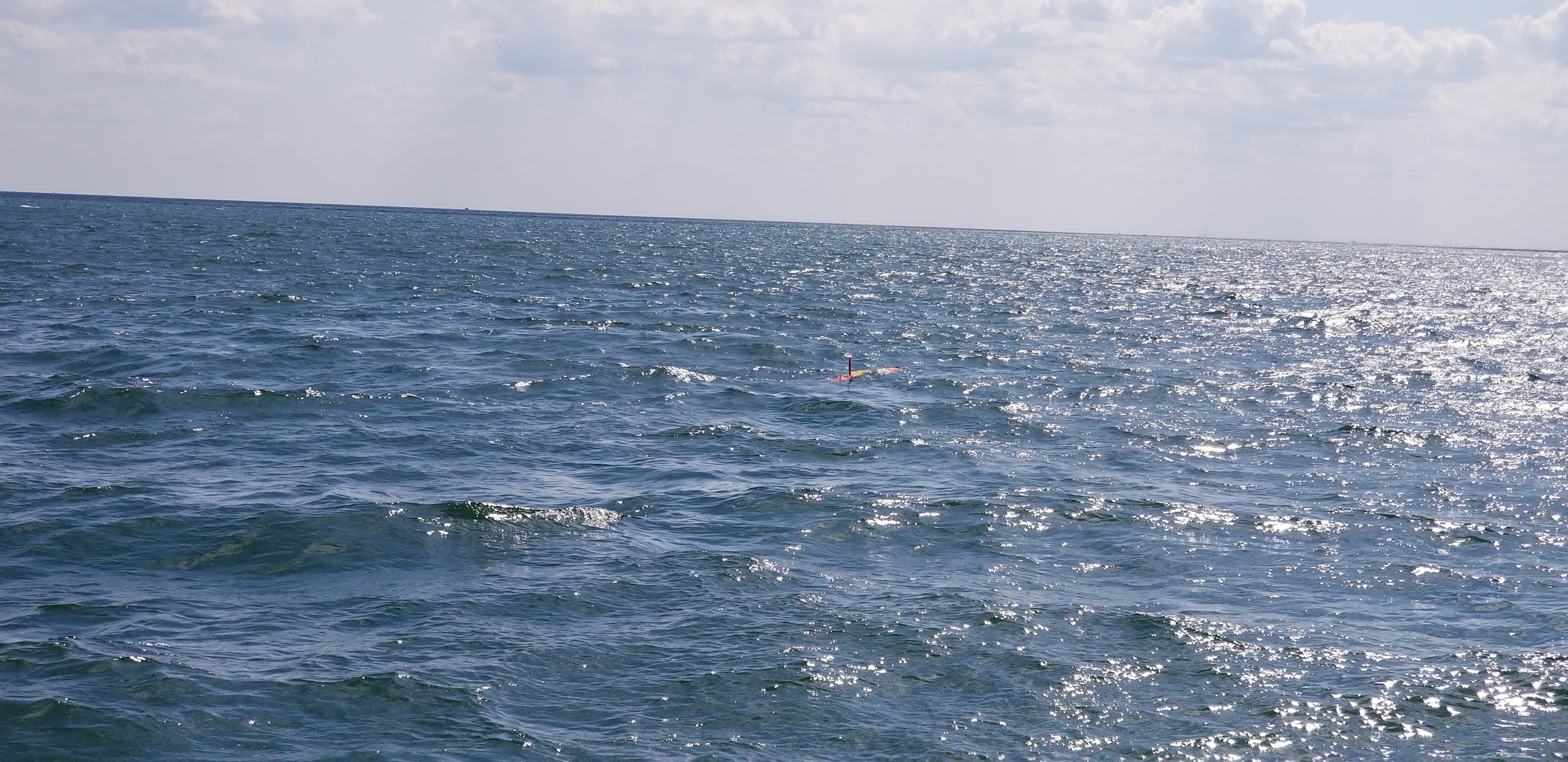
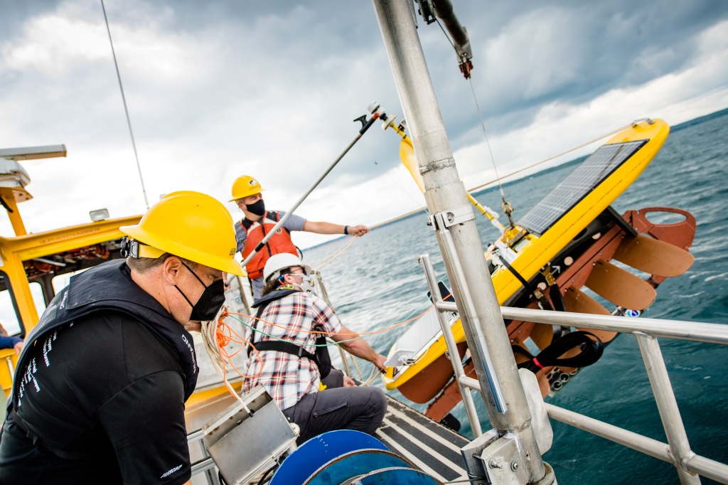
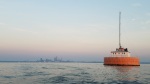
The NOAA Great Lakes Environmental Research Laboratory (GLERL) and Michigan Technological University (MTU) Great Lakes Research Center recently teamed up on the deployment of a wave glider in Lake Superior. The chemical and biological data collected will help researchers understand more about the Lake Superior foodweb and also be used to validate satellite information.
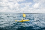
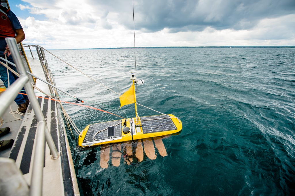
Autonomous wave glider that was recently deployed into Lake Superior by the MTU Great Lakes Research Center. Credit: Sarah Atkinson/Michigan Tech
Information gathered by autonomous vehicles, such as the wave glider, helps fine-tune satellite algorithms (instructions that tell a satellite how to interpret what it’s seeing). Satellites are a great tool for observing the lakes, as they provide a broader view than that from the ground. Researchers create Great Lakes-specific algorithms because those used in the ocean often do not work well in the lakes. The data collected by the wave glider will help validate the algorithms and allow researchers to understand more about the lakes, such as primary productivity (See MTU’s blog post for more.)
A team of researchers from MTU deployed the wave glider on August 30, 2021 and it spent 25 days surveying the lake and collecting data. The plan is to make the data public through the National Centers for Environmental Information (NCEI) so that information can be used in many ways including model development.
Path of the wave glider deployed on August 30th, 2021 and recovered on September 22, 2021 off the eastern coast of the Keweenaw Peninsula, near Bete Grise.
“It is a privilege for the Great Lakes Research Center to collaborate with NOAA GLERL on the wave glider experiment in Lake Superior, a first of its kind,” said Andrew Barnard, director of Michigan Tech’s Great Lakes Research Center. “This project continues to build a strong partnership between our organizations to push the boundaries of autonomy and sensing technologies. These new technologies in the Great Lakes support a better understanding of the physical processes in the lakes and will directly result in improved management insight for policy makers.”
Steve Ruberg of NOAA GLERL is thrilled with the MTU partnership as it expands our ability to collect data throughout the lakes. “Uncrewed vehicles give us the persistent large spatial observational capability to get in situ observations that will allow us to validate Great Lakes remote sensing.”
Left to right: Michigan Tech R/V Agassiz Jamey Anderson, assistant director of marine operations, Michigan Tech Great Lakes Research Center; Tim Havens, incoming director of the Great Lakes Research Center (January 2022) and John Lenters, associate research scientist at the Great Lakes Research Center ready the wave glider for deployment. Credit: Sarah Atkinson/Michigan Tech
This research project is a part of the Environmental Protection Agency’s Cooperative Science and Monitoring Initiative (CSMI). Federal and state agencies, tribal groups, non-governmental organizations and academic researchers from the United States and Canada team up yearly to assess conditions in one of the five Great Lakes. The survey focuses on a series of research areas that are tailored to the unique challenges and data needs associated with each lake.
Four years ago, NOAA’s Great Lakes Environmental Research Laboratory (GLERL) and the Cooperative Institute for Great Lakes Research (CIGLR) began providing an Experimental Lake Erie Hypoxia Forecast Model to warn stakeholders of low-oxygen upwelling events that can cause water quality problems for over 2 million residents of northern Ohio. Now in its fifth year, this forecast model has turned out to serve additional purposes that NOAA’s scientists hadn’t even considered – including maintaining sustainable fisheries and solving a smelly mystery!
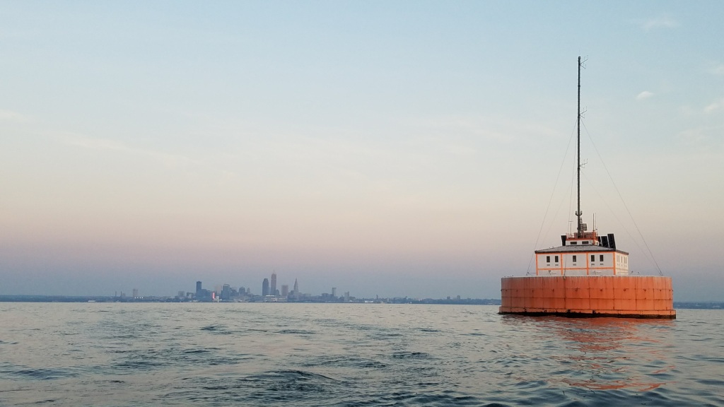
Water intake crib off the coast of Lake Erie in Cleveland, Ohio. By forecasting potential hypoxic upwelling events that could impact water quality, NOAA GLERL’s Experimental Hypoxia Forecast Model helps drinking water plant managers be prepared to adjust their treatment processes as needed.
Providing critical warnings to keep drinking water safe
Hypoxia – a state of low oxygen – occurs in the deep waters of Lake Erie’s central basin in July through September of most years. Low-oxygen water is an unfavorable habitat for fish, and may kill bottom-dwelling organisms that provide food for fish. While the hypoxic water generally stays near the lake floor, changes in wind and water currents can create upwelling events, in which this zone of low oxygen is brought to the surface along the coast.
Once it creeps into shallower parts of the lake, hypoxic water can upset drinking water treatment processes at water intakes along the shoreline. Hypoxic upwelling events cause rapid changes in water quality variables such as temperature, pH, dissolved organic matter, iron, and manganese. To maintain the quality of treated water, plant managers must adjust treatment in response to these changes. NOAA GLERL’s Experimental Hypoxia Forecast Model provides several days of advance notice that water quality is changing, so that drinking water plant managers can be prepared to adjust their treatment processes as needed.
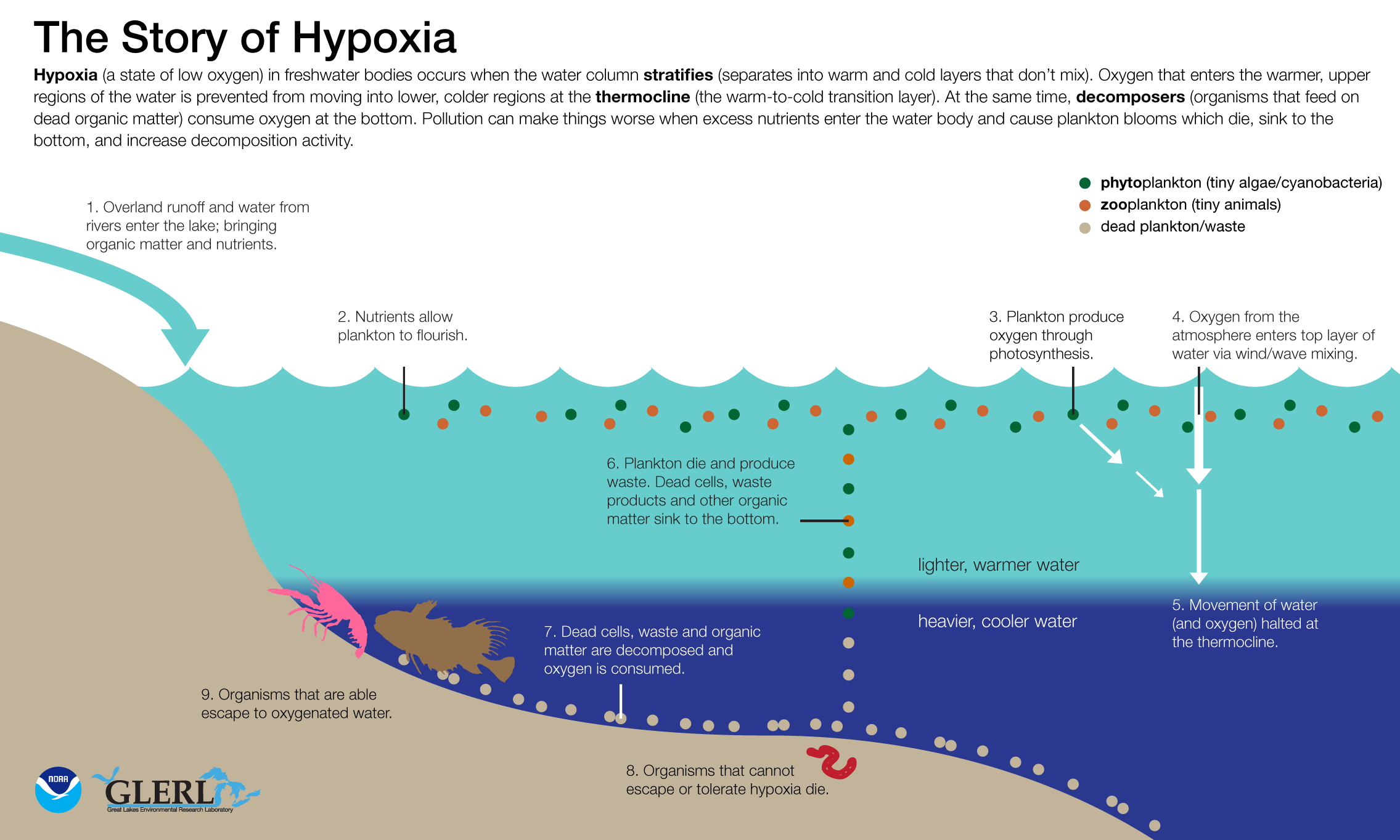
This infographic from NOAA GLERL describes how hypoxia occurs in large bodies of water like the Great Lakes.
Plot twist: Benefiting more than just our water supply
NOAA GLERL’s Experimental Lake Erie Hypoxia Forecast has proven to be incredibly successful in its original goal – but our scientists were surprised to learn that its usefulness didn’t stop there. Recent stakeholder interviews conducted by CIGLR Stakeholder Engagement Specialist Devin Gill revealed that, in addition to helping manage the drinking water treatment process, the forecast has also become an unexpectedly vital tool for managing Lake Erie’s fisheries.
One agency that makes use of the experimental hypoxia forecast is the Ohio Department of Natural Resources (DNR). The Ohio DNR is responsible for generating population estimates for Lake Erie’s yellow perch and walleye – estimates that ultimately help determine official catch limits to maintain the lake’s sustainable fisheries.
“Large aggregations of fish may seek refuge at the edges of the hypoxic zone,” says Ann Marie Gorman, a fisheries biologist with the Ohio DNR’s Fairport Harbor Fisheries Research Station. “Our office tracks the location of the lake’s cold bottom water using the NOAA GLERL Hypoxia Forecast Model, and we may modify the timing of some of our surveys to minimize the potential impact of hypoxia on the results. Overall, the NOAA GLERL Hypoxia Forecast Model has become an integral tool for our survey planning.”
Understanding fish behaviors in response to hypoxia is important to conducting accurate population surveys of Lake Erie’s fish species. The ability of NOAA GLERL’s hypoxia forecast to warn fisheries managers of potential survey bias from these hypoxic events helps to save time, money, and energy that may have otherwise been used to conduct unsuccessful trawling surveys in hypoxic zones.
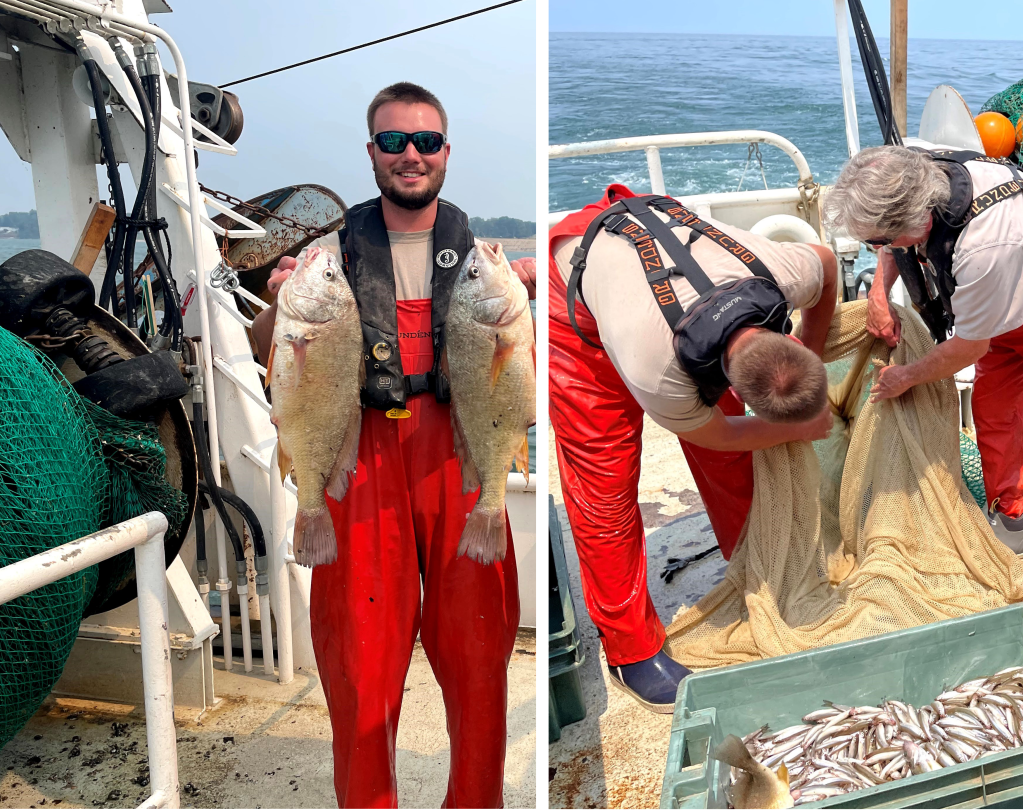
NOAA GLERL’s Experimental Hypoxia Forecast Model helps to guide the planning of trawling surveys like this one conducted by the Ohio Department of Natural Resources. Consulting the forecast helps the Ohio DNR to minimize the potential impact of hypoxia on survey results, which are used to set catch limits that keep Lake Erie’s fisheries sustainable. Photo credit: Ohio Department of Natural Resources.
Richard Kraus, a supervisory research fish biologist with the United States Geological Survey (USGS) Great Lakes Science Center Field Station in Ohio, also uses the experimental hypoxia forecast for his work with Lake Erie’s fisheries. Kraus explains that in Lake Erie, several cold-water fish species rely on finding refuge in colder, deeper waters of the lake – waters that are not impacted by warmer summer air temperatures. However, the presence of hypoxic zones in these deeper waters can impact how much refuge is available for these fish. As hypoxia reduces refuge habitats for cold-water species, chronic effects on growth and reproduction may develop, and in severe circumstances fish kills sometimes occur. The NOAA GLERL Hypoxia Forecast Model is instrumental in predicting where these potential ecosystem impacts could occur, in turn helping fisheries managers determine sustainable catch limits for each fish species in question.
The experimental forecast was also found to be useful to commercial and recreational fishers, who use the forecast to gauge the distribution of yellow perch in relation to hypoxic zones. Fishers can utilize the forecast on a daily basis to determine where to launch their boats, and where to search for aggregations of fish, depending on the hypoxia forecast for that day.
Plus, it’s not just routine fisheries management and recreation that the Experimental Hypoxia Forecast helps improve. In early September, it helped solve the mystery of a strange, foul smell coming from Lake Erie near Cleveland, Ohio, and fish kills associated with it. These phenomena resulted in many public inquiries regarding suspected gas leaks or pollutant spills. Thanks to the forecast, public officials knew that an upwelling of hypoxic water had recently occurred, likely carrying sulfur and nitrogen compounds that caused the stench, and were able to quickly eliminate other possible causes.
Half a decade in the making
Since it began in 2017, this NOAA project has grown into much more than just a computer model. The Experimental Lake Erie Hypoxia Forecast model was developed as a five-year project (2017-2021) with funding from NOAA’s Coastal Hypoxia Research Program, and is an extension of the Lake Erie Operational Forecasting System at NOAA’s Center for Operational Oceanographic Products and Services. Co-led by NOAA GLERL research scientists Drs. Mark Rowe and Craig Stow, and CIGLR’s Dr. Casey Godwin, project scientists provide an email update to public water systems, fisheries managers, and other stakeholders ahead of likely hypoxic events that contains links to the experimental forecast website and other useful NOAA webpages.
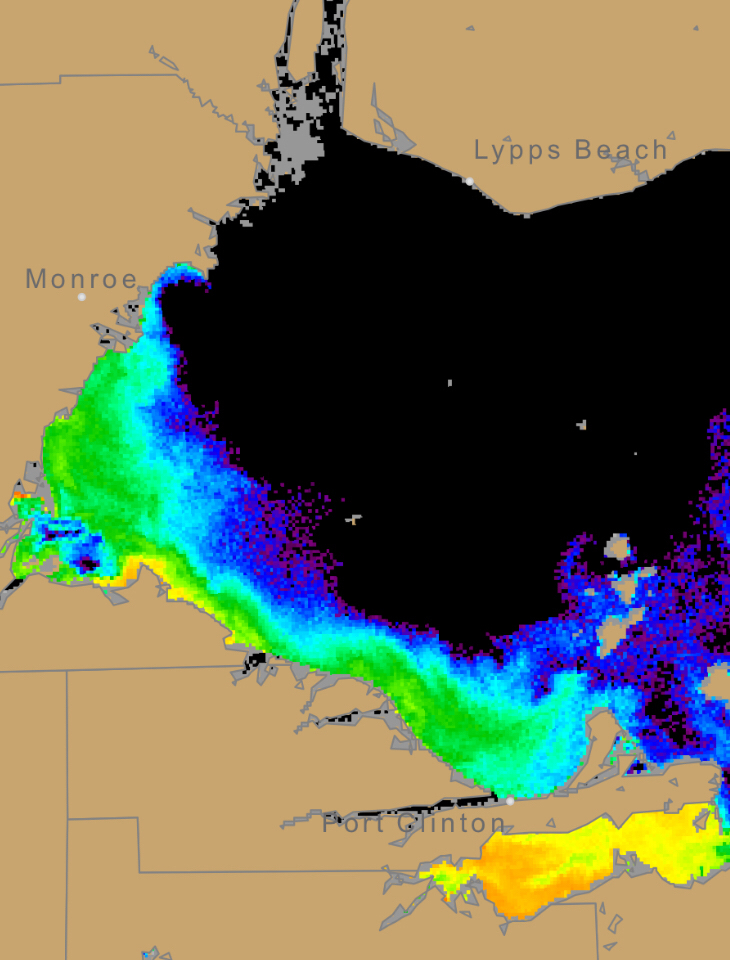
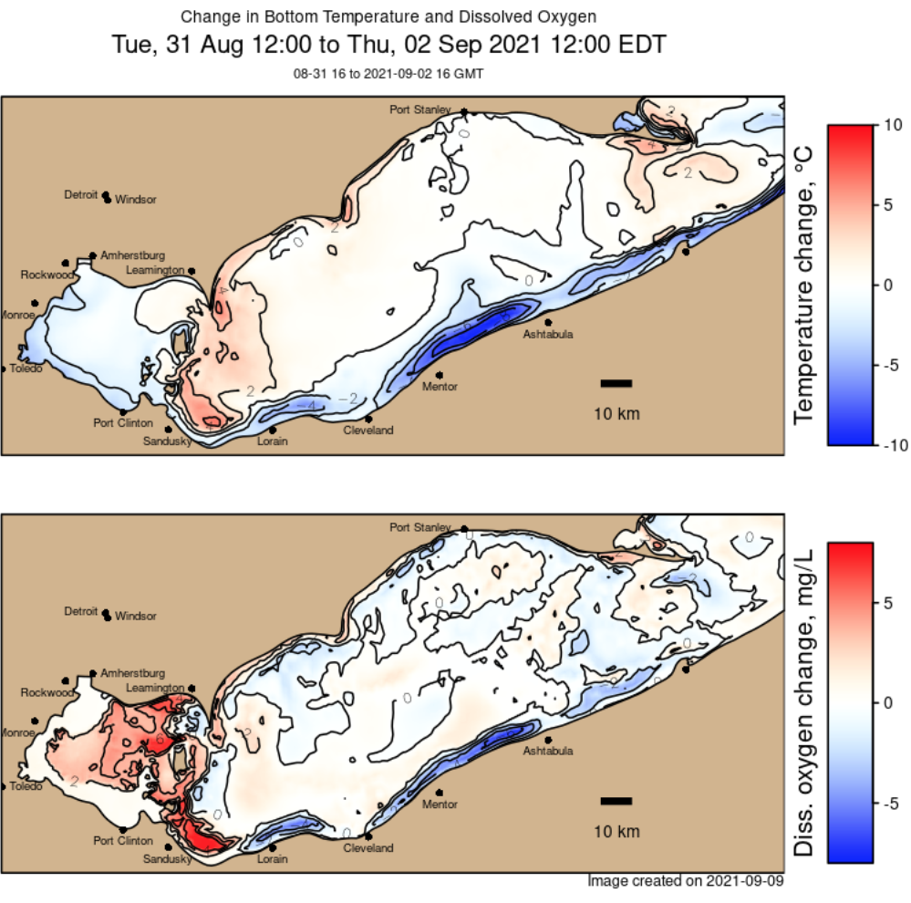
Map from the NOAA GLERL Experimental Lake Erie Hypoxia Forecast Model showing predicted change in Lake Erie temperature (top) and dissolved oxygen (bottom) during a three-day hypoxic upwelling event from August 31 to September 2, 2021.
Partners on this project include Ohio public water systems (including the cities of Cleveland and Avon Lake), NOAA’s National Ocean Service, and the Great Lakes Observing System. Special thanks to Devin Gill from the Cooperative Institute for Great Lakes Research for contributing stakeholder interview findings for this article.
A new video SMART BUOYS: Preventing a Great Lakes Drinking Water Crisis released by Ocean Conservancy describes how NOAA forecast models provide advance warnings to Lake Erie drinking water plant managers to avoid shutdowns due to poor water quality.
An inter-agency team of public and private sector partners, working with the Cleveland Water Department, are addressing drinking water safety for oxygen depleted waters (hypoxia). By leveraging NOAA’s operational National Weather Service and National Ocean Service forecast models and remote sensing for the Great Lakes, NOAA’s latest experimental forecast models developed by its Great Lakes Environmental Research Laboratory can predict when water affected by harmful algal blooms and hypoxia may be in the vicinity of drinking water intake pipes. Advance notice of these conditions allows water managers to change their treatment strategies to ensure the health and safety of drinking water.
“Hypoxia occurs when a lot of organic material accumulates at the bottom of the lake and decomposes. As it decomposes, it sucks oxygen from the water, can discolor the water and allow for metals to concentrate,” explains Devin Gill, stakeholder engagement specialist for NOAA’s Cooperative Institute for Great Lakes Research, hosted at the University of Michigan.
Low dissolved oxygen on its own is not a problem for water treatment. However, low oxygen is often associated with a high level of manganese and iron in the bottom water that then leads to drinking water color, taste, and odor problems. In addition, the same processes that consume oxygen also lower pH and, if not corrected, could cause corrosion in the distribution system, potentially elevating lead and copper in treated water.
“Periodically, this water with depleted oxygen gets pushed up against the shoreline and the drinking water intakes pipes,” said Craig Stow, senior research scientist for NOAA’s Great Lakes Environmental Research Laboratory. “We have buoys stationed at various places and those guide our models to let us know when conditions are right for upwellings that would move this hypoxic water into the vicinity of the drinking water intakes.”
NOAA provides advanced warning of these events so that drinking water plant managers can effectively change their treatment strategies to address the water quality, which is a huge benefit in the water treatment industry.
A buoy near the Cleveland Water intake—approximately 3.5 miles off the Cleveland shoreline—gives researchers at NOAA GLERL the ability to incorporate water temperature, pH, turbidity, dissolved oxygen and other parameters into their Experimental Hypoxia Forecast model. This allows water treatment managers enough time to anticipate and respond to changes in lake water quality before it is drawn into their treatment plants. Photo Credit: Ed Verhamme, Limnotech
CIGLR Mechanical Technician, Russ Miller, and Research Associate, Dack Stuart retrieve a sediment core from Lake Erie, near the Cleveland Water Intake Crib. Photo Credit: CIGLR
CIGLR Mechanical Technician, Russ Miller, prepares to deploy temperature and dissolved oxygen sensors in Lake Erie, near the Cleveland Water Intake Crib. Photo Credit: CIGLR
Retrospective animation of the Experimental Lake Erie Hypoxia Forecasts from the 2018 season, showing the predicted change in bottom temperature and dissolved oxygen.
Cleveland skyline and Cleveland Water Intake Crib. Daily, about 165 million gallons of water leaves Lake Erie through the crib to the pump station, where the water will begin treatment before it flows to other water facilities. Photo Credit: Ed Verhamme, Limnotech.
CIGLR Associate Director & Research Scientist, Tom Johengen, works hard to understand more about Lake Erie hypoxia by measuring sediment oxygen demand. Photo Credit: Michele Wensman, CIGLR.
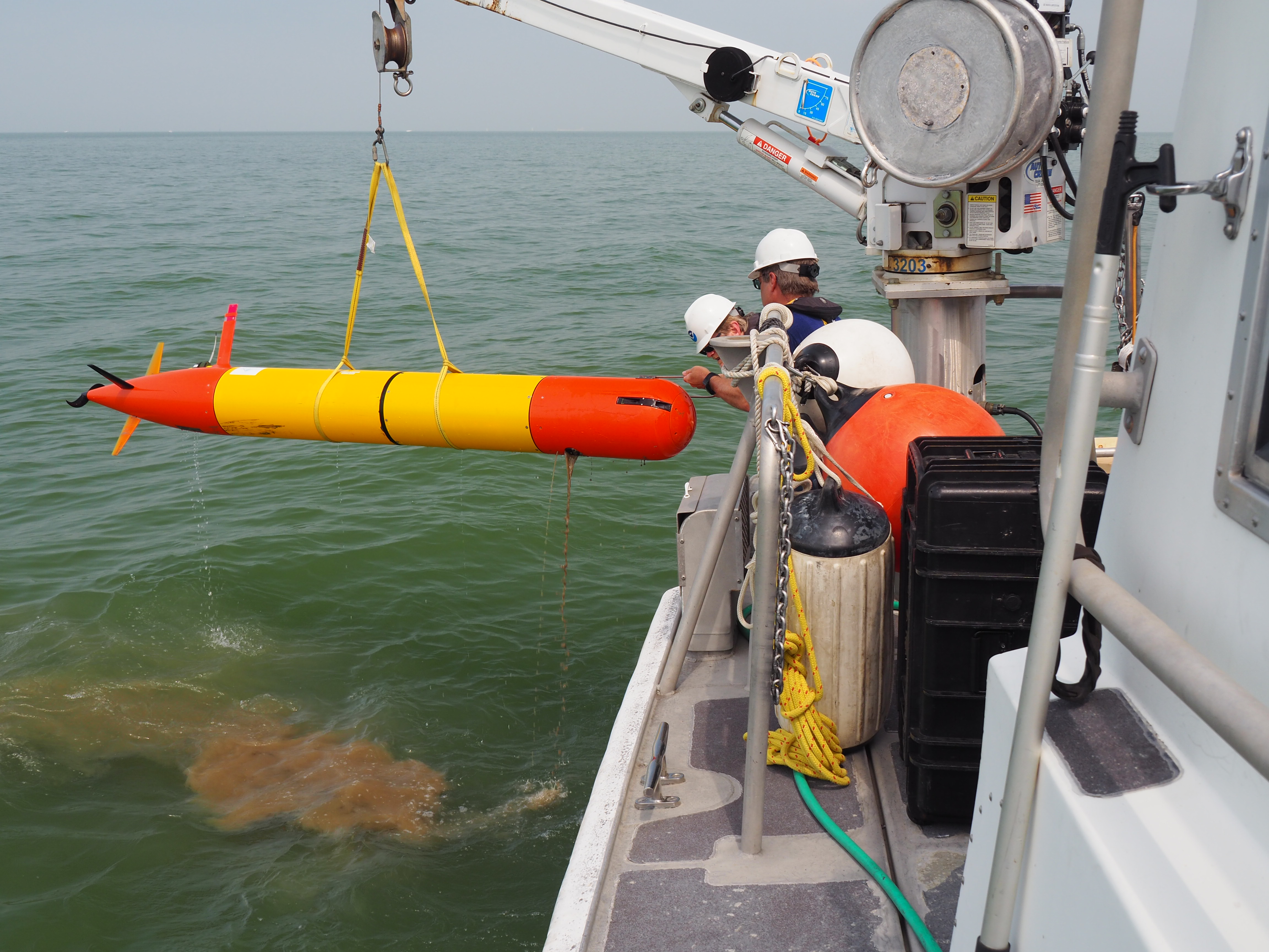
In late July and early September, during the peak of the 2018 harmful algal bloom in the Western Basin of Lake Erie, NOAA GLERL, NOAA National Centers for Coastal Ocean Science (NCCOS), NOAA Atlantic Oceanographic and Meteorological Laboratory (AOML) and CIGLR researchers teamed up with a group of scientists and engineers from the Monterey Bay Research Institute (MBARI). Their mission: to test how well a third-generation environmental sample processor (3GESP), mounted inside a long-range autonomous underwater vehicle (LRAUV), can track and analyze toxic algae in the Western Basin of Lake Erie. You can read more about the purpose of this project in this great news story by MBARI’s Kim Fulton-Bennett.
Below is a photo story showing all (well, much) of the hard work that went into this test deployment.
First, the new gear had to be shipped from California to the GLERL laboratory in Ann Arbor, Michigan.
On the truck and heading to Michigan!
Ready to go.
It’s load out day!
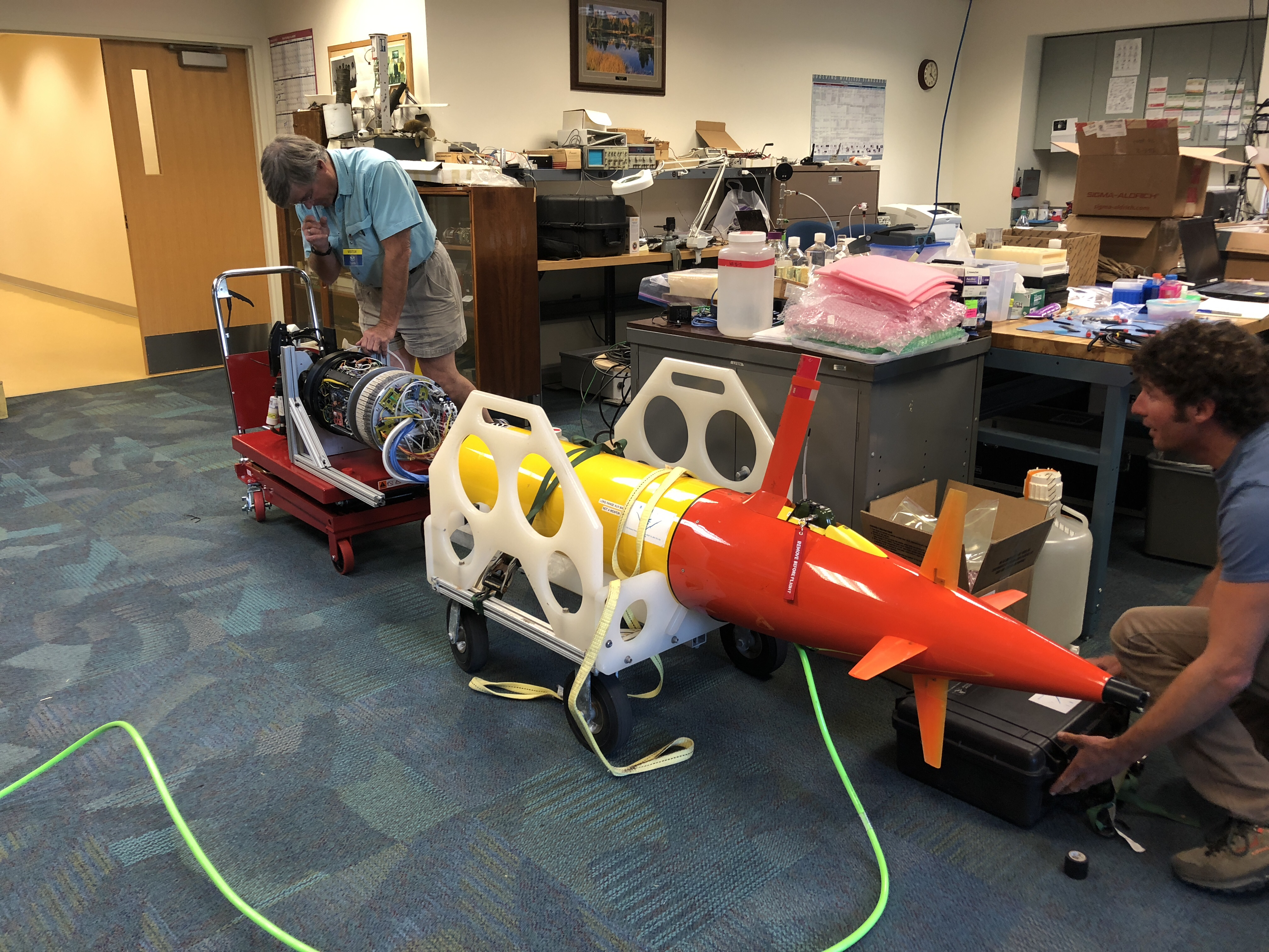
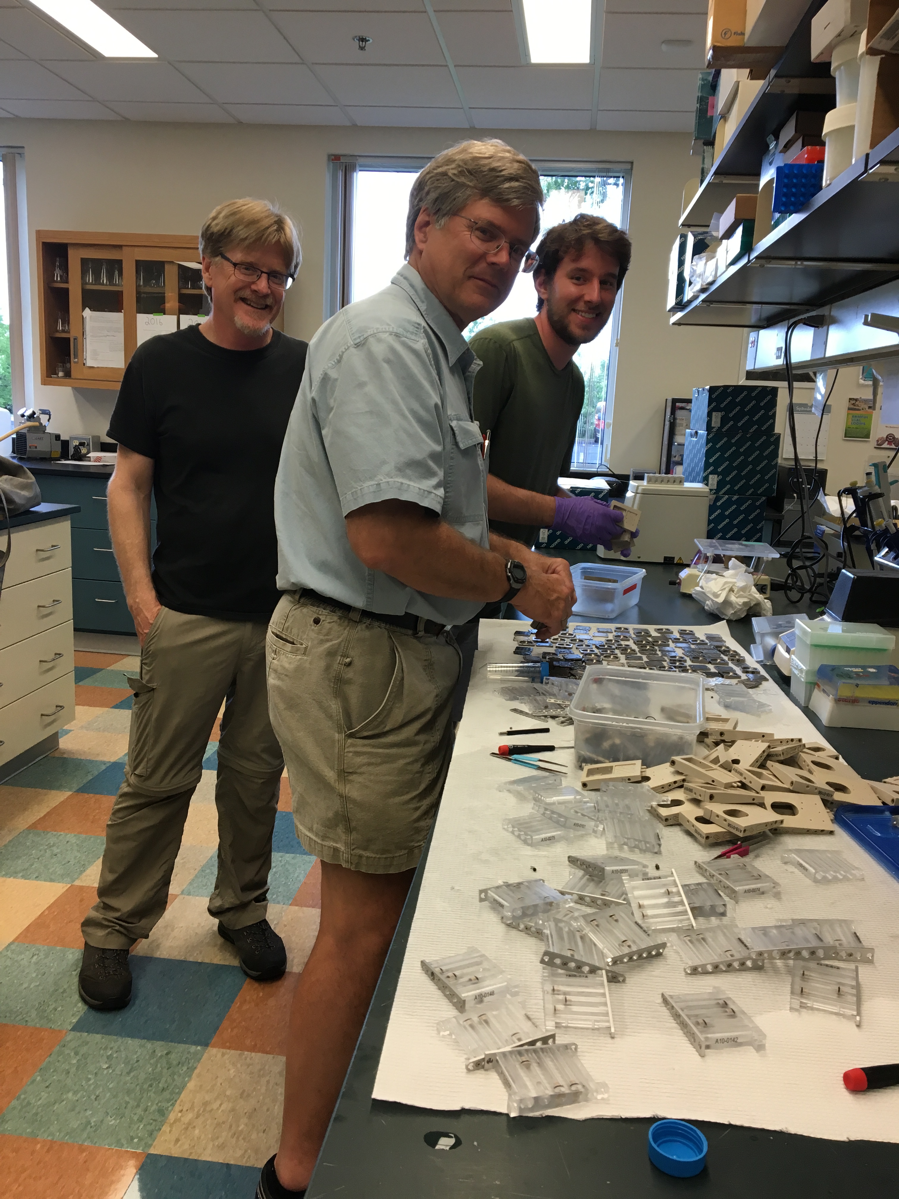
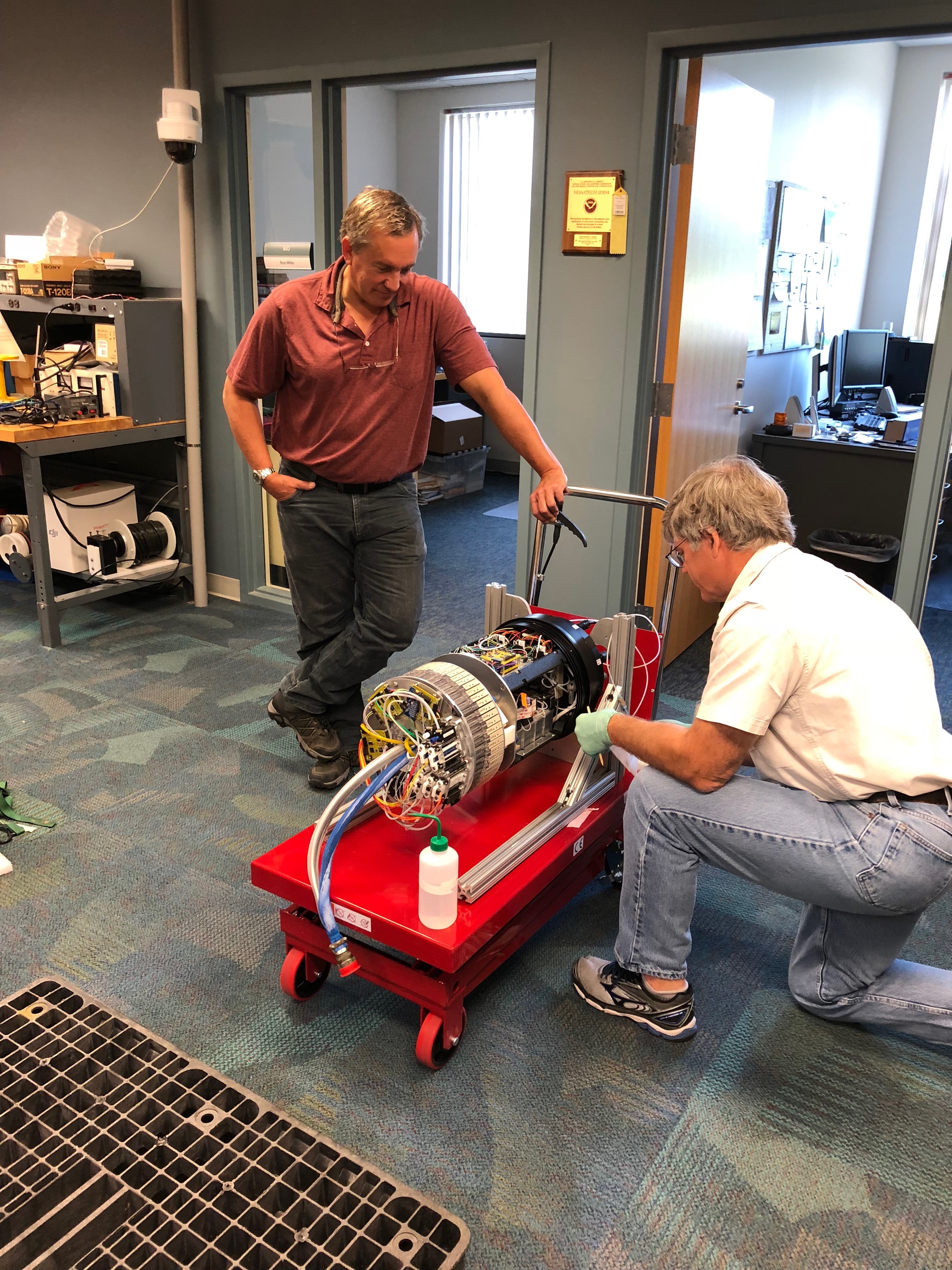
Upon arrival, Jim Birch, Director of the MBARI SURF (Sensors Underwater Research of the Future) Center, & Bill Ussler, MBARI biogeochemist, got straight to work in GLERL’s Marine Instrumentation Lab.
The inside of the 3G ESP has a lot of moving parts. Since this is the first time the team is testing it in freshwater, before it can go out, everything needs to be fine-tuned to work in a variety of conditions in Lake Erie (more on that later.)
So. Many. Moving. Parts.
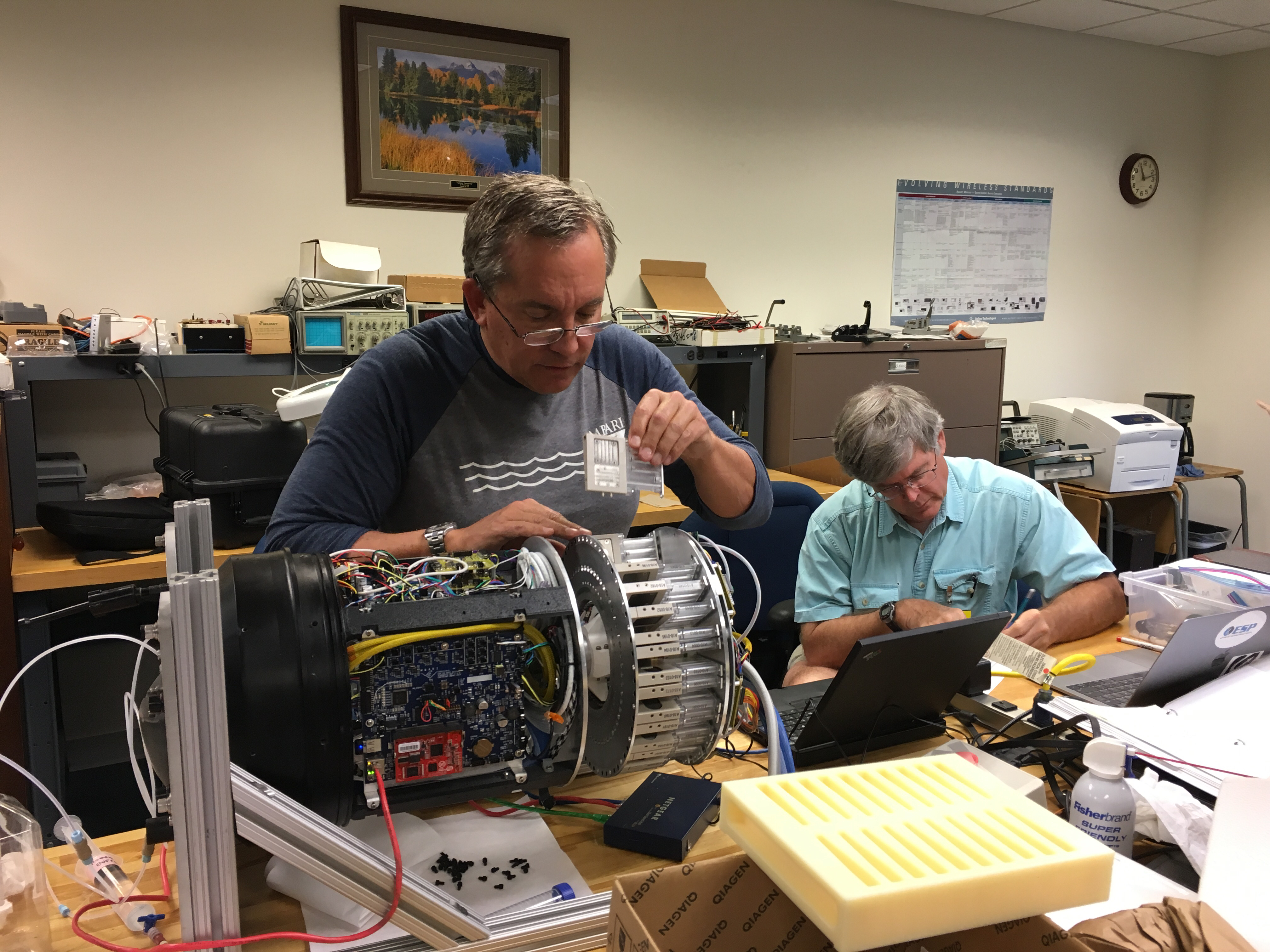
Running a test sample.
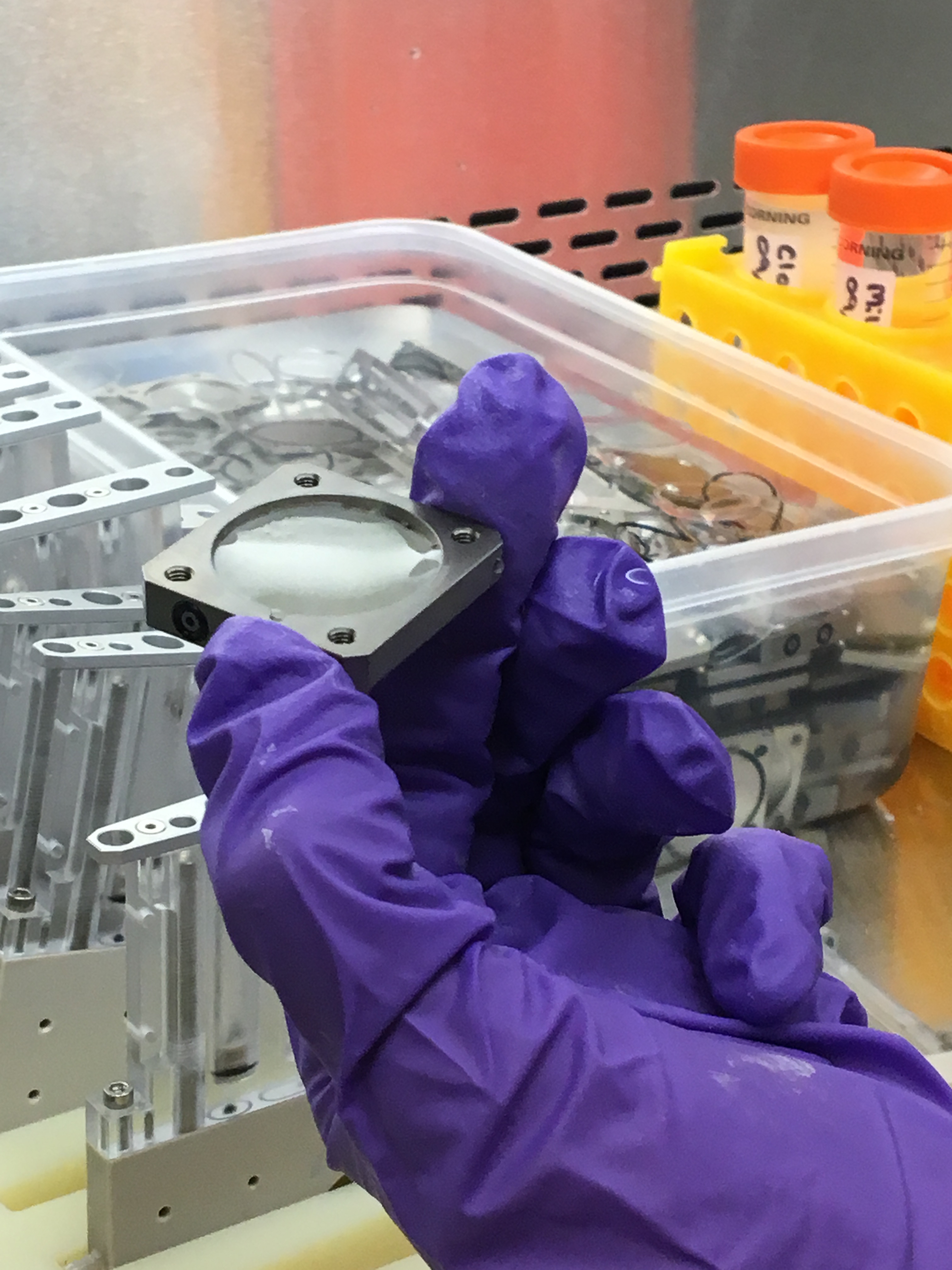
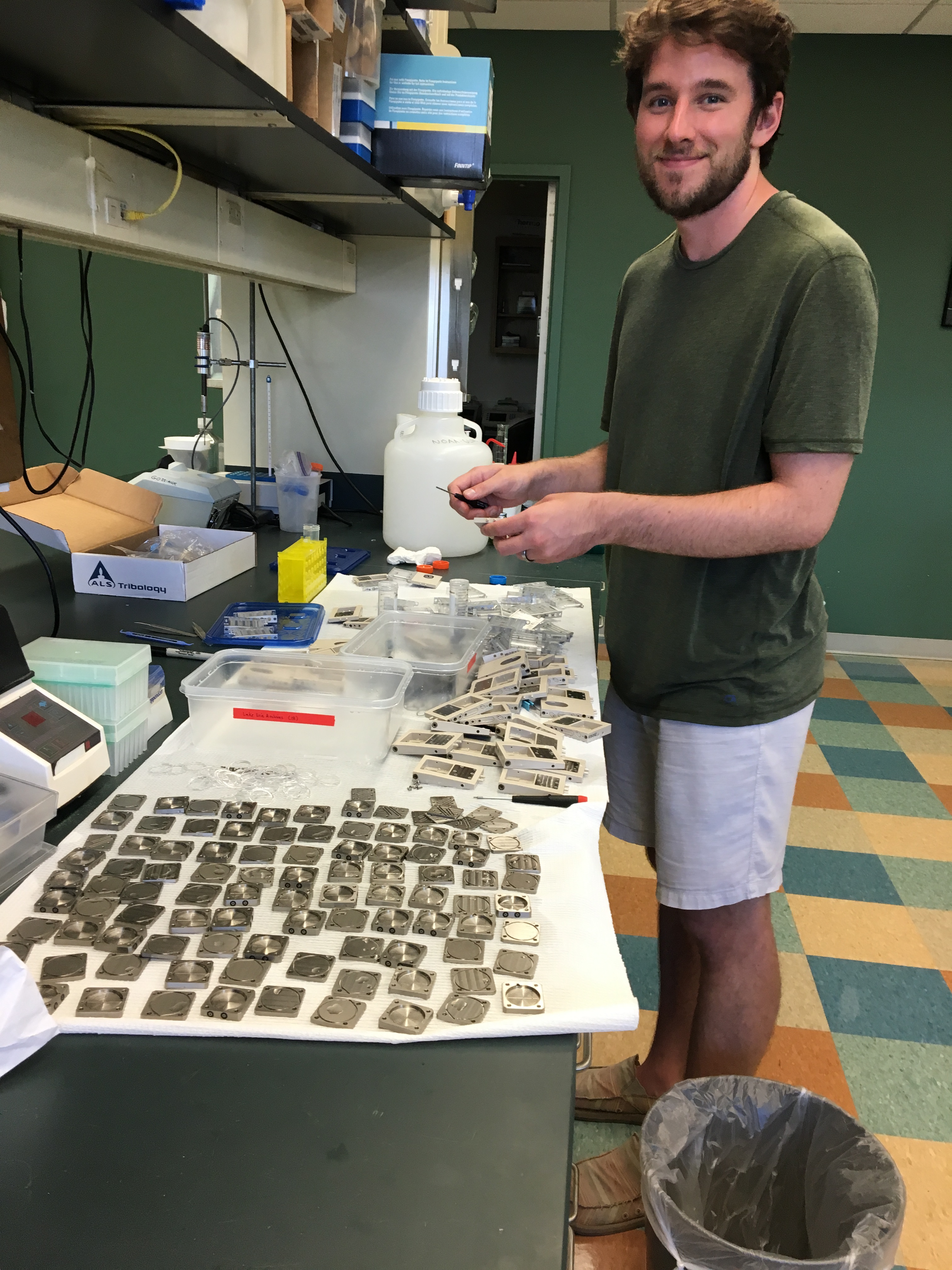
Cartridges that hold the water sample for both real-time processing, as well as an archive sample for further analysis back in the lab.
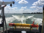
The propeller end of the long-range AUV in which the 3GESP will be housed.
More testing and tweaking.
The “guts” of the 3GESP prior to inserting the cartridges.
Once everything is in working order, the 3GESP gets inserted into an LRAUV or long-range autonomous underwater vehicle (the torpedo-looking thing). This gives the 3GESP the ability to move around in the water all by itself once researchers have set parameters for it. The team has named this particular vehicle, Makai, which is Hawaiian for “toward or by the sea.” Seems appropriate! That’s Brian Kieft, MBARI software engineer, on the right. He plays a crucial role in making sure Makai does her job.
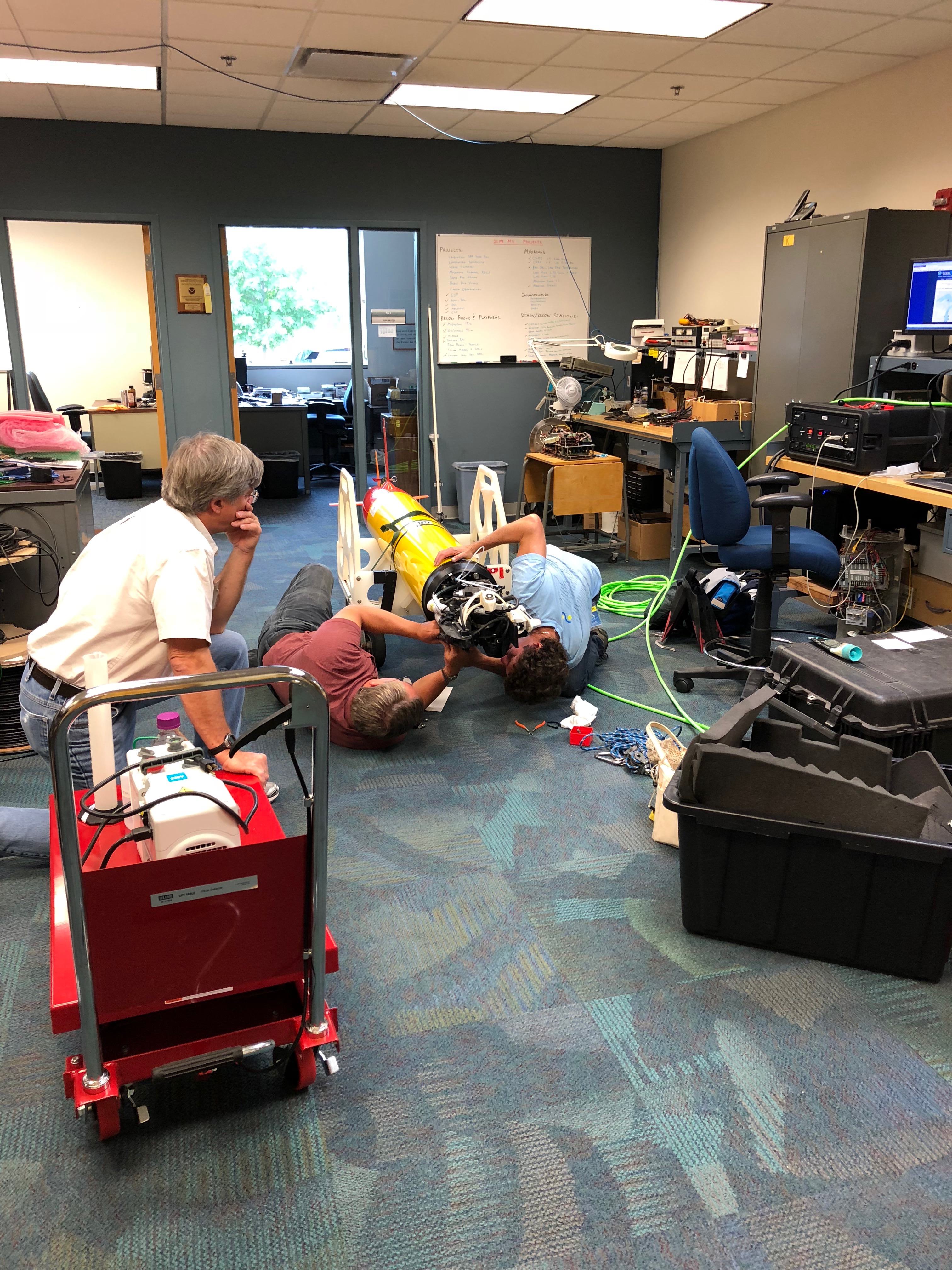
All hands on deck for a few more tweaks.
Once everything is installed tightly, helium is added into the canister to check for leaks. CIGLR engineer, Russ Miller, is working with Jim to fill it up.
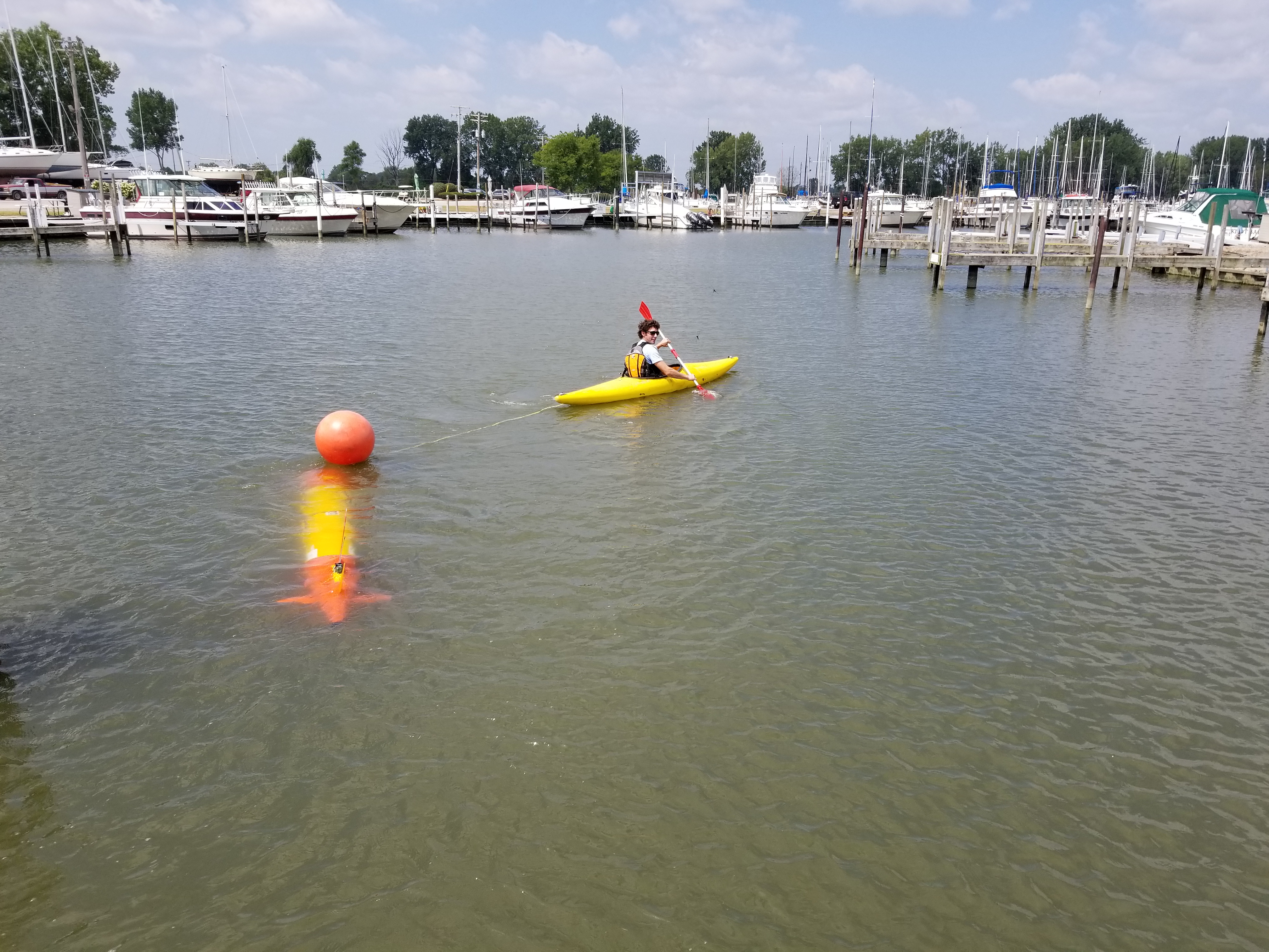
Now, the team is ready to head out to Lake Erie. Here’s where things start to get exciting!
A kayak? What do we need that for? You’ll see.
Loading the Makai into the van.
Heading to Toledo Beach Marina in La Salle, Michigan .
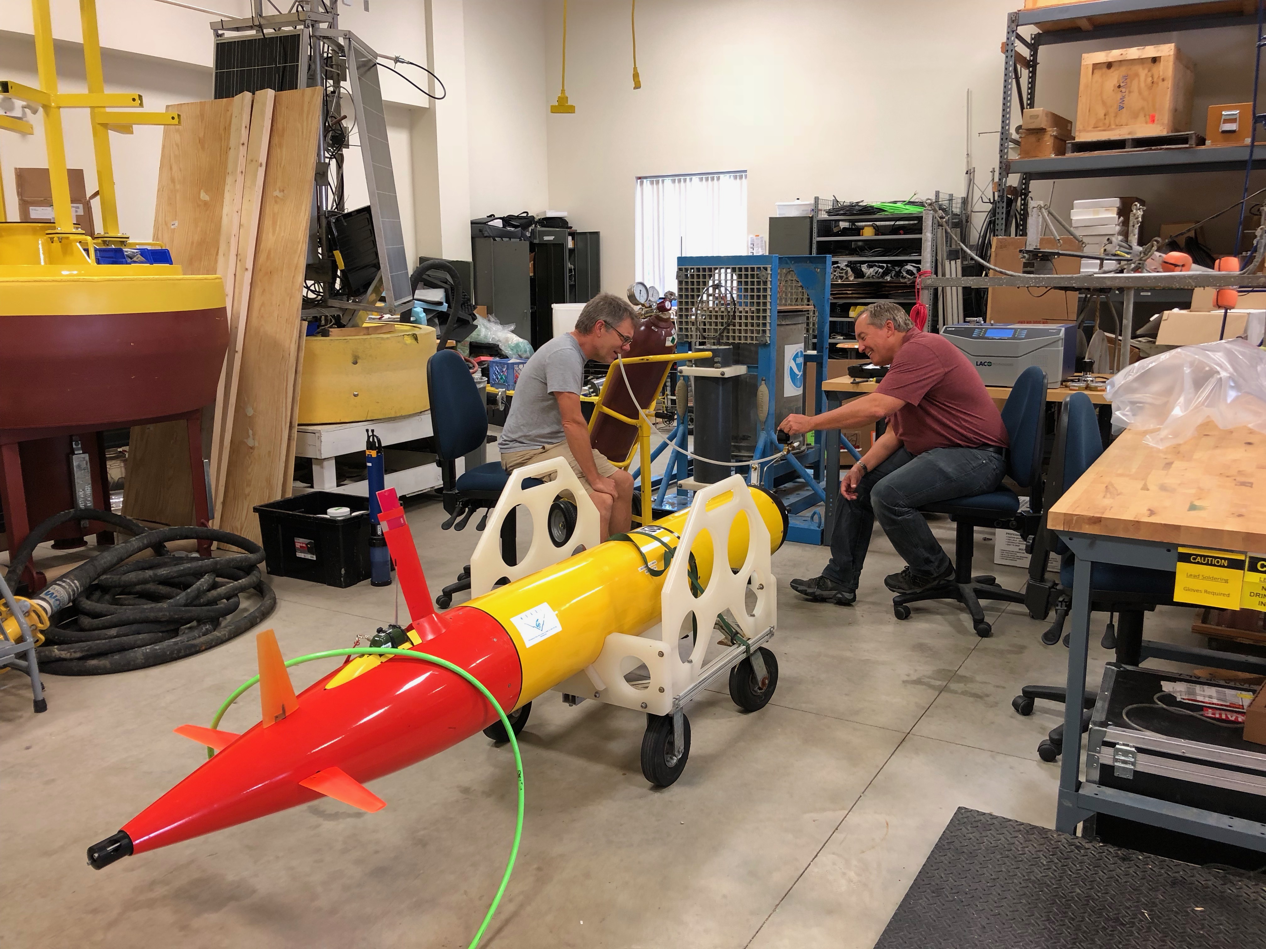
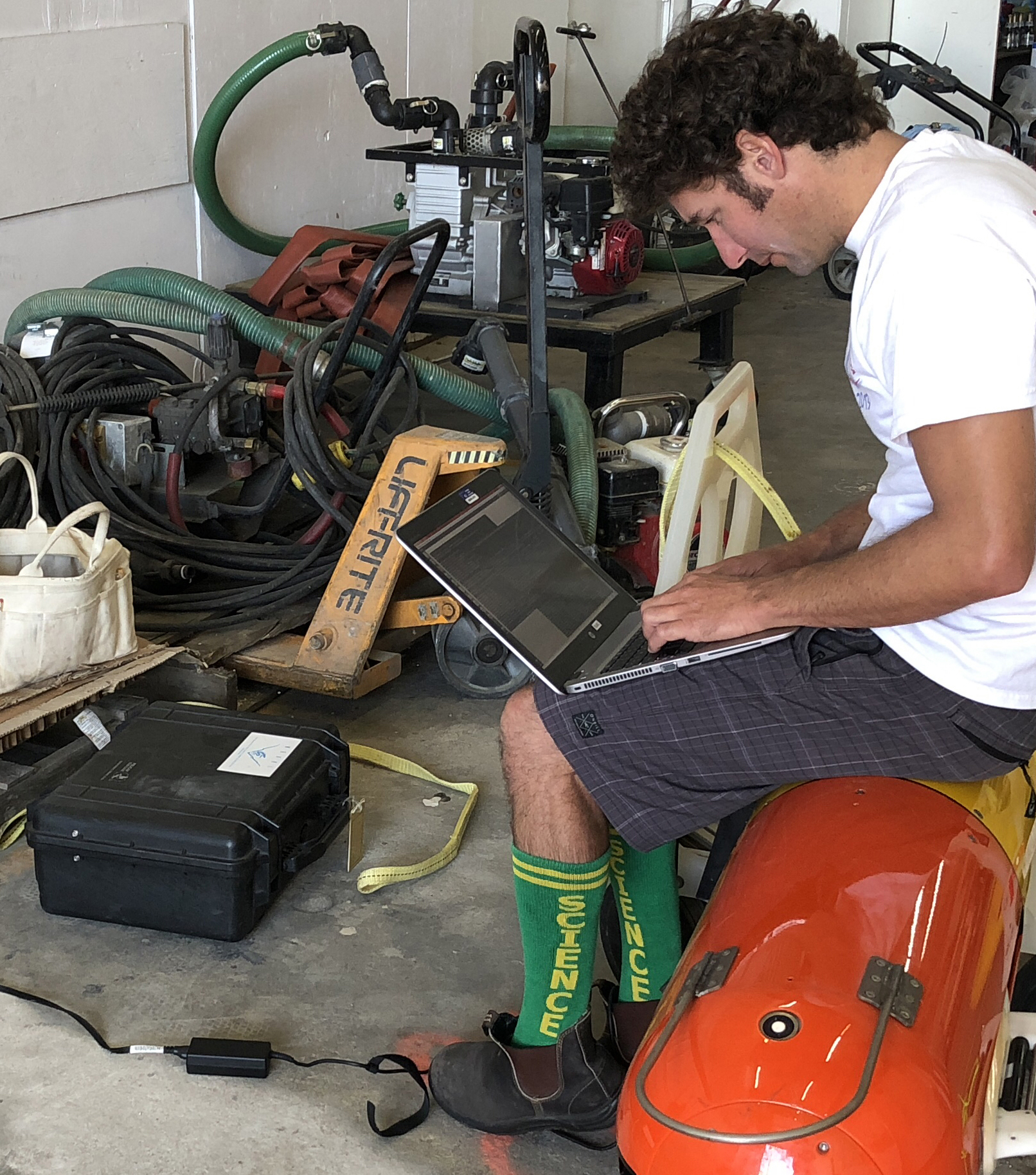
Before the team sets Makai free to track the algal bloom in the Western Basin of Lake Erie, they must first check her ballast and trim. This is especially important for such a shallow lake (relative to where the team has been testing this technology in the deep canyons of of Monterey Bay off the coast of California.)
Brian has to do all of the hard work.
Because, science.
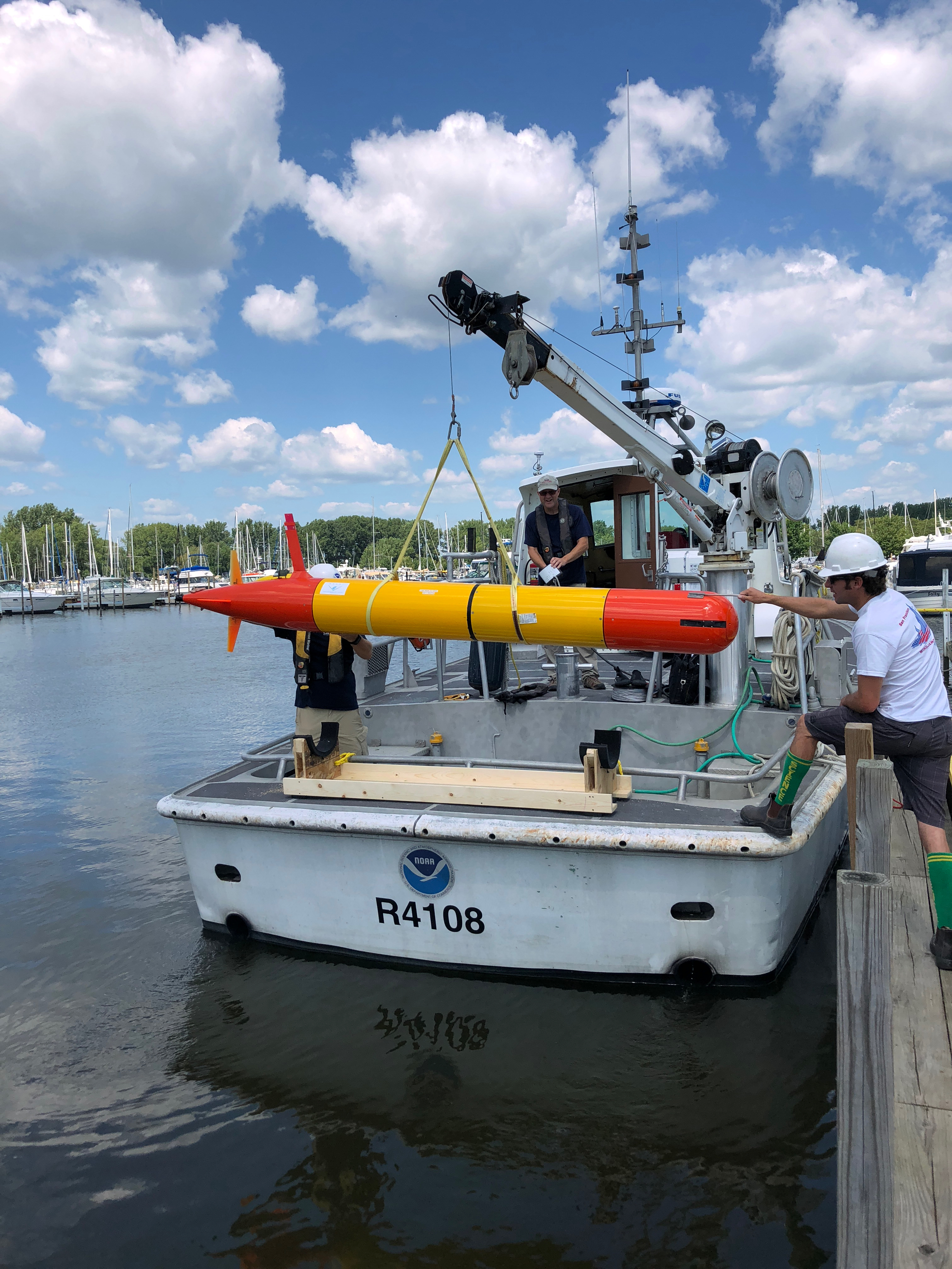
Time to load Makai onto the NOAA vessel, which is stationed in La Salle, Michigan. Captain Kent Baker, a contractor with NOAA, is in the background operating the crane. Kent takes NOAA and CIGLR researchers and technicians out to bi-weekly sampling stations, helps deploy buoys and other instrumentation, and is at the ready for pretty much anything that needs to happen in Lake Erie.
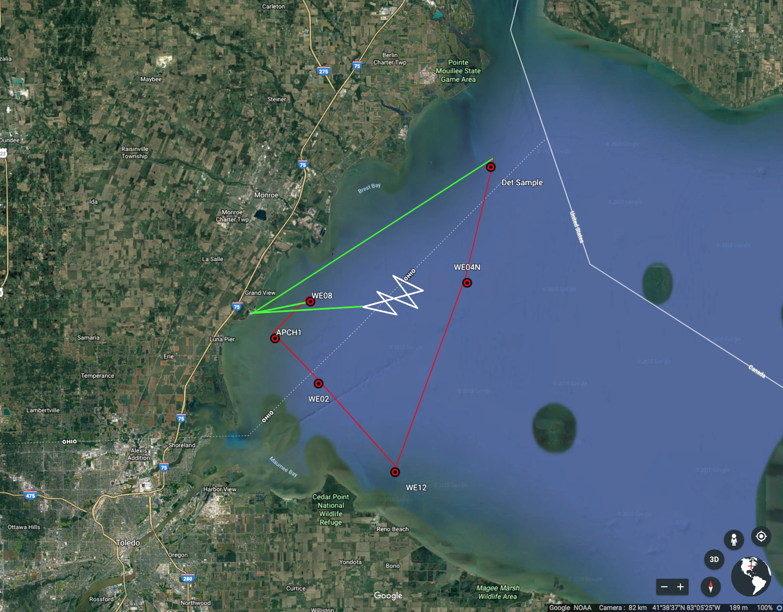
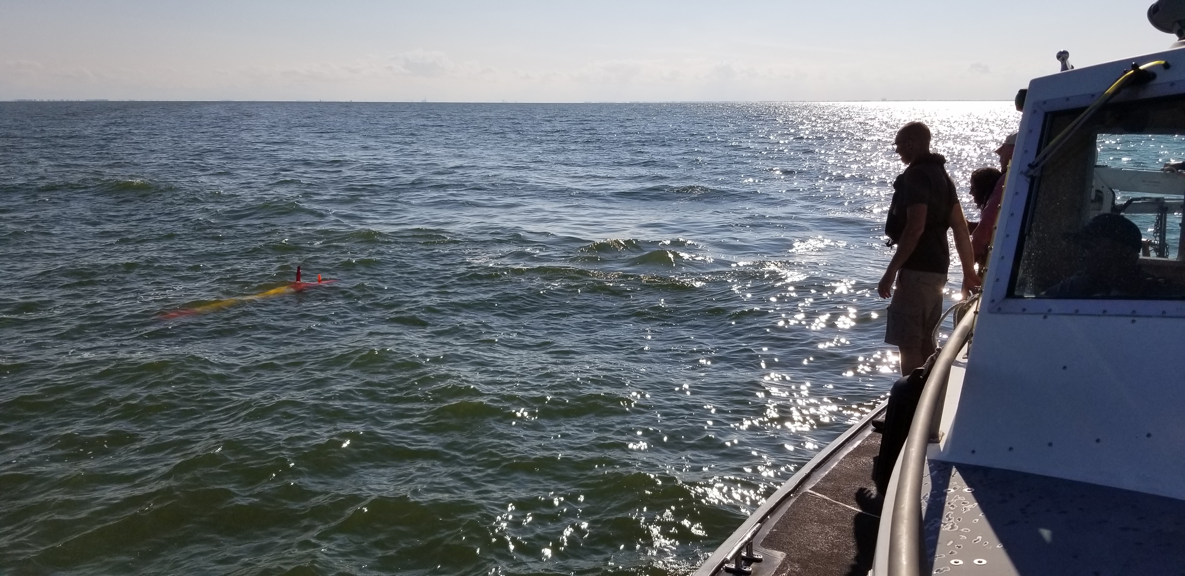
Once she’s all settled onto the boat, the team takes Makai to the first deployment location.
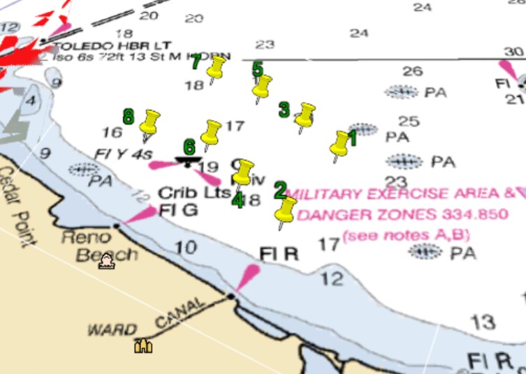
Then, they would determine how many samples to take, and program her to go to specific waypoints.
Remember when we said this Lake Erie mission will be different than the ones the team has performed in Monterey Bay? Well, here’s one example of how.
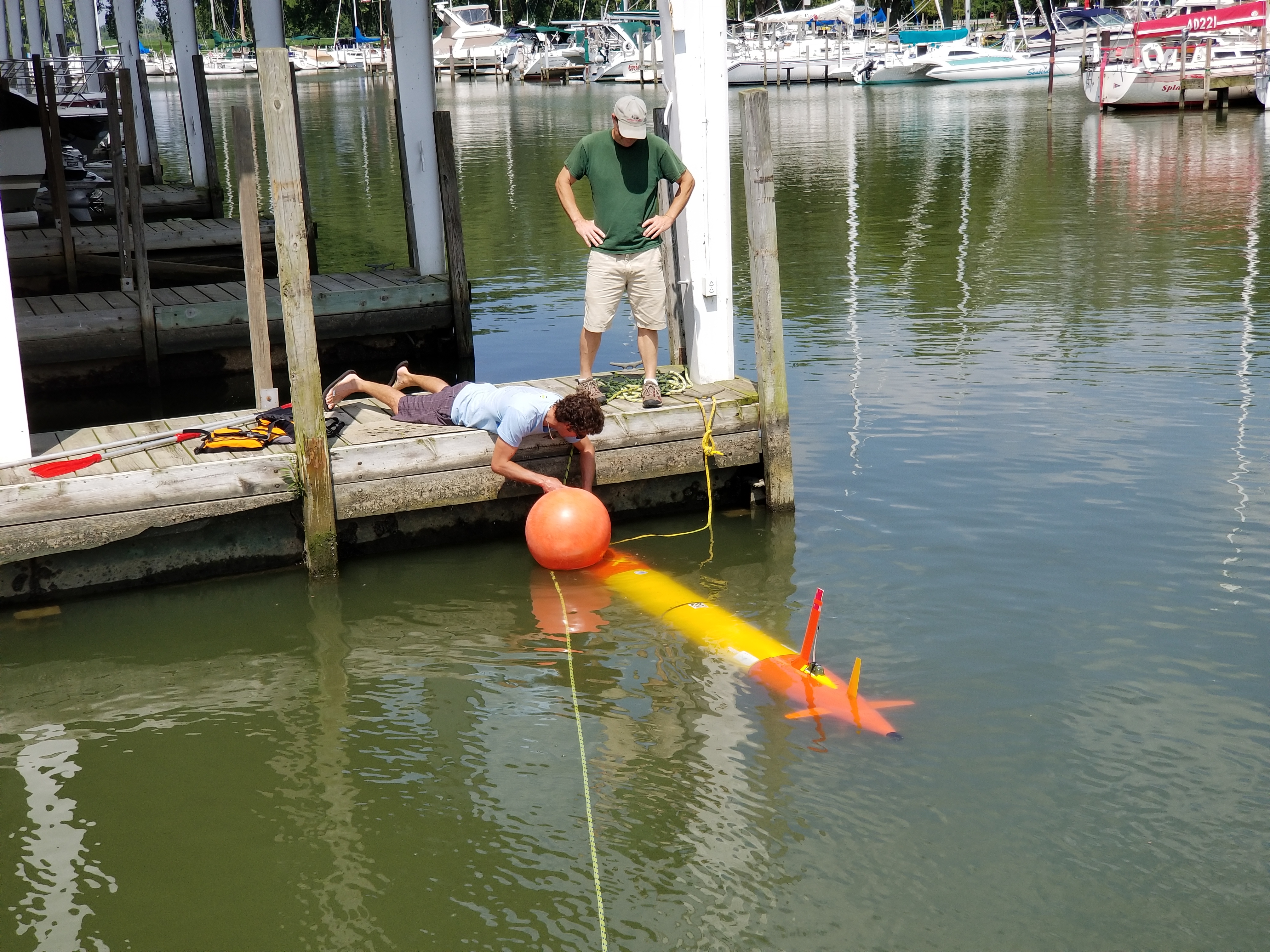
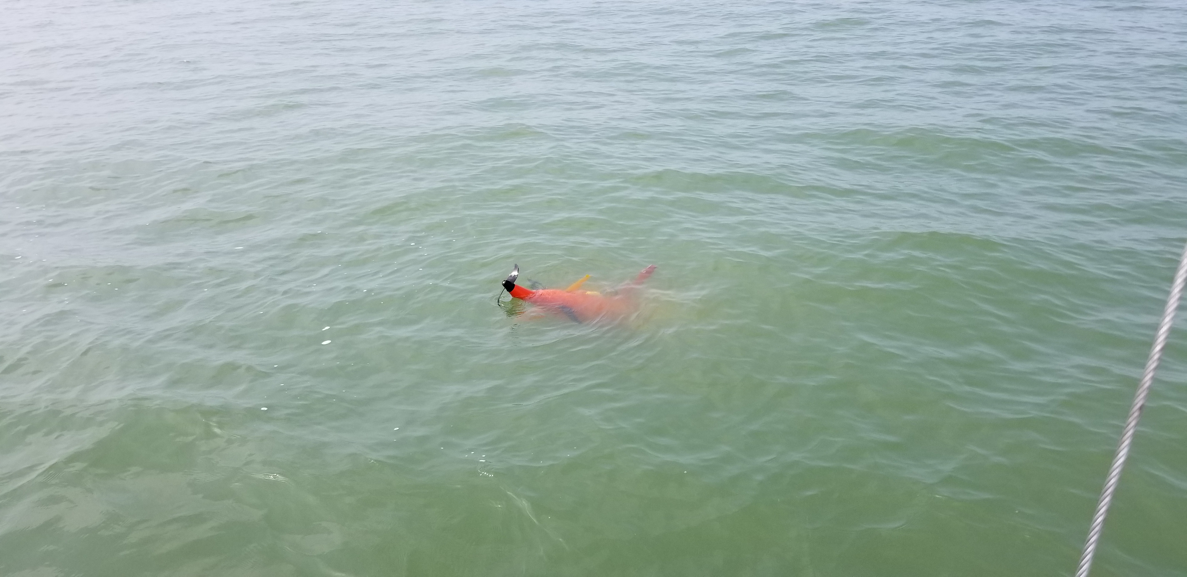
After a few hours of no communication, and a little hunting, this is how the team found Makai. Two problems here: One, with the propellor up and the nose down, Makai cannot transmit data, including her location, as the transmitter only works above water. And, two, well . . .
The reason she was nose down in the first place is because Lake Erie is pretty shallow, and she’d taken on quite a bit of mud.
Once she was all cleaned up, the team set Makai out again to complete the rest of her mission.
Once the deployment was over, the research didn’t stop there.
Archive samples were taken so that folks back in the lab could further analyze them.
Here’s GLERL’s Observing Systems and Advanced Technology (OSAT) branch chief, Steve Ruberg (left), along with Paul Den Uyl, a researcher with CIGLR, helping Bill extract the sample filters from the cartridges.
The filters are being collected for analysis of DNA. The DNA will be extracted from each filter and analyzed. We’re looking at absolute quantity of known microcystin producing toxin genes in samples collected, information on bacterial community composition, and information on eukaryotic organism community composition. The samples will also analyzed through shotgun sequencing. This is where all of the genes in the sample are turned into human readable information and can be combined to make what can be thought of as an organism’s genetic instruction guide (what genes it has). This information will be very helpful in better understanding what causes the algae to be toxic (not all algae is toxic).
Lake Erie’s “dead zone” not only impacts the lake’s ecosystem, but also poses challenges for managers of drinking water treatment facilities. The Lake Erie dead zone is a region of the central basin where oxygen levels within the water become extremely low, creating a condition known as hypoxia. Great Lakes researchers are sharing their scientific expertise to help managers be fully prepared for threats to drinking water resulting from hypoxic conditions.
Scientists from NOAA GLERL, Cooperative Institute for Great Lakes Research (CIGLR) and the Great Lakes Observing System (GLOS) met on May 23 in Cleveland, Ohio with water plant managers from the southern shore of Lake Erie for a stakeholder engagement workshop to discuss the hypoxia issue. An important focus of the workshop was the development of a new hypoxia forecast model that will act as an early warning system when hypoxic water has the potential to enter intakes of water treatment facilities. The depletion of oxygen in hypoxic water occurs when the water column stratifies (separates into warm and cold layers that don’t mix). Oxygen in the lower, cold layer becomes depleted from the lack of mixing with the upper (warm) layer that is exposed to air, as well as from the decomposition of organic matter (dead plants and animals) in the lower layer. The process of hypoxia is illustrated by GLERL’s infographic, The Story of Hypoxia.
Stakeholders who attended the workshop explained that water treatment operators must be prepared to respond quickly during a hypoxic event to ensure that drinking water quality standards are met. Hypoxic water often is associated with low pH and elevated manganese and iron. Manganese can cause discoloration of treated water, while low pH may require adjustment to avoid corrosion of water distribution pipes, which can introduce lead and copper into the water.
At the workshop, researchers shared information on lake processes that contribute to hypoxia and on development of the Lake Erie Operational Forecasting System that provides nowcasts and forecasting guidance of water levels, currents, and water temperature out to 120 hours, and is updated 4 times a day. Information was also shared on preliminary hypoxia modeling results that simulated an upwelling event (wind-driven motion in the Great Lakes, pushing cooler water towards the lake surface, replacing the warmer surface water) that brought hypoxic water to several water plant intakes in September, 2016. Water plant managers reported that advance notice of a potential upwelling event that could bring hypoxic water to their intakes would be useful to alert staff and potentially increase the frequency of testing for manganese.
Dr. Mark Rowe from University of Michigan, CIGLR, researcher and co-lead on this initiative, comments on the value of this hypoxia stakeholder engagement workshop: “At both NOAA and the University of Michigan, there is an increasing focus on co-design of research, which refers to involving the end-users of research results throughout the entire project, from concept to conclusion. If we succeed, a new forecast model will be developed that will be run by the operational branch of NOAA. This can only happen if there is a group of users who request it. This workshop provided critical information to the researchers regarding the needs of the water plants, while also informing water plant managers on how forecast models could potentially help them plan their operations, and on the latest scientific understanding of hypoxia in Lake Erie. ”
Stakeholder Scott Moegling, Water Quality Manager at City of Cleveland Division of Water, also recognizes the value of engagement between the stakeholders and the Great Lakes researchers. Moegling points out that “the drinking water plant managers not only benefit from sharing of operational information and research, but also by establishing lines of communication between water utilities and researchers that help identify common areas of interest. The end result—researchers providing products that can be immediately used by water utilities—is of obvious interest to the water treatment industry on Lake Erie.” Moegling also views the GLERL/CIGLR research on the hypoxia forecast model as holding great potential in predicting hypoxic conditions in Lake Erie and believes that once the model is developed and calibrated, there may be a number of other possibilities for highly useful applications.
In addition to sharing the latest research on hypoxia, the stakeholder engagement workshop provided a forum for water plant managers to share information with each other on how to recognize hypoxic events and efficiently adjust water treatment processes. Researchers at CIGLR and NOAA GLERL are committed to conduct research that serves society, and will continue to work with this stakeholder group over the course of the five-year project to develop a hypoxia forecast model that meets their needs.
NOAA GLERL harmful algal blooms research program featured on Detroit Public Television
As part of a series on The Blue Economy of the Great Lakes, NOAA’s Great Lakes Environmental Research Laboratory (GLERL) is featured in a short video, produced by Detroit Public Television (DPTV) and published on the DPTV website. The video, which features GLERL and its partners from the Cooperative Institute for Great Lakes Research (CIGLR, known formerly as CILER), describes the advanced technology GLERL uses to monitor, track, predict, and understand harmful algal blooms (HABs) in the Great Lakes. More specifically, the video focuses on efforts in Lake Erie, where over 400,000 people were affected by a 3-day shutdown of the Toledo drinking water treatment facility in 2014. Since then, GLERL and CIGLR have enhanced their HABs research program—much of which is made possible by funding from the Great Lakes Restoration Initiative, or GLRI—to include cutting-edge technologies such as the hyperspectral sensorsand an Environmental Sample Processor (ESP), as well as experimental forecasting tools like the Lake Erie HAB Tracker.
In addition to online coverage, the video will be broadcast via DPTV at a future time, yet to be determined.
A collaborative research team, led by Drs. Craig Stow of the National Oceanic and Atmospheric Administration’s Great Lakes Environmental Research Laboratory (NOAA GLERL) and Mark Rowe of the University of Michigan’s Cooperative Institute for Limnology and Ecosystems Research (CILER), will be holding a workshop with key stakeholders for guidance on how a forecast model could help meet the needs for information on low oxygen conditions—or hypoxia—in Lake Erie. The workshop, coming up later this spring, kicks off a 5-year project that brings together inter-agency and university scientists to produce a forecasting system that will predict the location and movement of hypoxic water in Lake Erie. The project will link a hypoxia model to NOAA’s Lake Erie Operational Forecasting System (LEOFS) hydrodynamic model, which provides daily nowcast and 5-10 day forecasts of temperature and currents in Lake Erie.
Hypoxia occurs in the central basin of Lake Erie in July through September of most years. Low-oxygen water is an unfavorable habitat for fish, and may kill benthic organisms that provide food for fish. It is less well known, however, that hypoxic water can also upset drinking water treatment processes. Upwelling or seiche events can bring hypoxic water to water intakes along the shoreline, causing rapid changes in dissolved oxygen and associated water quality variables such as temperature, pH, dissolved organic matter, iron, and manganese. To maintain the quality of treated water, plant managers must adjust treatment in response to these changes. Hypoxia forecasts will provide several days advance notice of changing source water quality so that drinking water plant managers can be prepared to adjust treatment processes as needed.
While the hypoxia forecasting project will help to minimize the negative impacts of hypoxia, a parallel effort is occurring to address the root cause of this problem involving nutrient loading. Universities, state, federal, and Canadian agencies are collaborating to satisfy the goals of the Great Lakes Water Quality Agreement by reducing nutrient loads to Lake Erie, a primary stressor driving hypoxic conditions.
The upcoming stakeholder workshop on hypoxia will bring the research team together with stakeholders consisting of municipal drinking water plant managers from U.S. and Canadian facilities on Lake Erie, as well as representatives of state and local agencies. The group will learn about hypoxia and its effects, hear about the goals of the LEOFS-Hypoxia project, and provide input to the research team on their information needs. As the first in a series of meetings of the project’s Management Transition Advisory Group, this workshop will help identify the most useful data types and delivery mechanisms, laying the groundwork for the research team to design a forecasting tool that specifically addresses the needs of public water systems on Lake Erie.
The workshop will be held at Cleveland Water in Cleveland, Ohio. Representatives from Ohio Environmental Protection Agency (EPA), Ohio Department of Natural Resources, Ohio Sea Grant, townships and other local governments were also invited to attend.
The LEOFS-Hypoxia project is a collaboration with the City of Cleveland Division of Water, Purdue University, and U. S. Geological Survey, with guidance from a management advisory group including representatives from Ohio public water systems, Ohio EPA, Great Lakes Observing System (GLOS), and NOAA. The work is supported by a $1.4 million award from the NOAA National Centers for Coastal Ocean Science (NCCOS) Center for Sponsored Coastal Ocean Research by a grant to NOAA GLERL and University of Michigan (award NA16NOS4780209).
Getting to the root cause of the problem
As part of an initiative conducted under the auspices of the Great Lakes Water Quality Agreement, Annex 4, the following forums, led by Dr. Craig Stow at GLERL, will focus on the linkage of nutrient loading to water quality degradation problems, such as hypoxia and harmful algal blooms.
4/5-6: Nutrient Load Workshop
5/9-10: Annex 4 (nutrients) Subcommittee Meeting
Scientists attending these workshops will apply long term research results to estimate nutrient inputs to Great Lakes waters and evaluate how well we are doing in reaching phosphorus load reduction targets established under Annex 4 of the GLWQA.
How can airplanes help predict harmful algal blooms (HABs)?
For several years the National Oceanic and Atmospheric Administration (NOAA) has been using satellites to guide HAB forecasts. But, satellites have their limitations. For example, the Great Lakes region can be cloudy and satellite “cameras” can’t see through clouds. In western Lake Erie there are typically only about 20-30 usable cloud-free images during the HAB season, which limits our ability to make bloom predictions. Another challenge with satellites is that the resolution of images makes it difficult for scientists to “see” differences in the types of algae floating on the Lake Erie surface. After a big rainstorm, for instance, it is difficult to distinguish between muddy water flowing in from the Maumee River and algae that is already in the western basin.
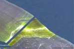
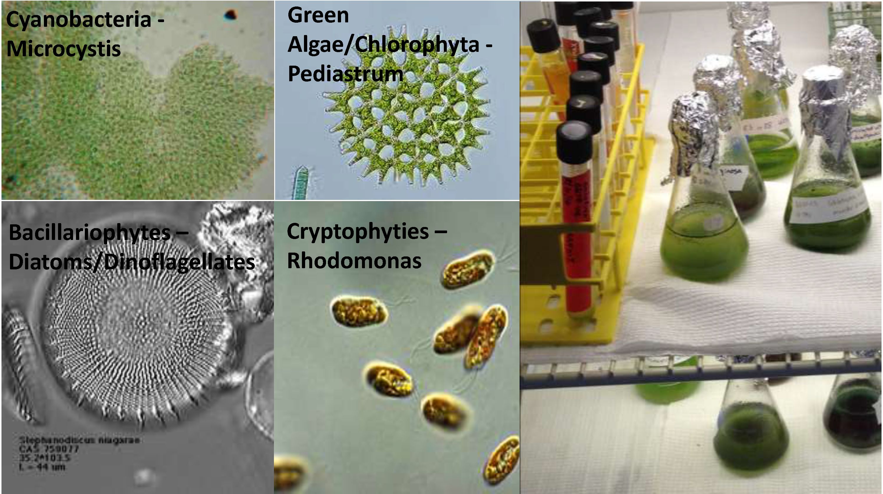
The resolution of satellite images makes it difficult to distinguish the types of algae floating on the surface of the water. We can detect different algae in the lake because each algae group (shown above) releases a different color pigment that we can ‘see’/ measure from the hyperspectral sensor.
To improve HABs forecasts, during the past two summers, GLERL has been partnering with the Cooperative Institute for Limnology and Ecosystems Research (CILER) and Skypics to use a special hyperspectral sensor on an airplane-mounted camera. This weekly airborne campaign is coordinated with the weekly Lake Erie monitoring program. The monitoring program collects samples at multiple stations around western Lake Erie and the hyperspectral sensor captures images from those sampling stations on the same day. Comparing the field collected samples with what the sensor “sees” helps us to understand how well the sensor is working for HAB detection. Additionally, we coordinate with researchers at NASA’s Cleveland office, who are also flying their own airborne imaging sensor, to cross check our results with theirs for even more robust hyperspectral data validation and quality control.
Check out this short video clip of a HAB, taken by pilot, Zach Haslick, from Skypics, as seen from the window of his airplane, while flying the hyperspectral sensor over an area of Lake Erie.
Like satellites, hyperspectral sensors collect information on HAB location and size, but since our weekly hyperspectral flyovers are done below the clouds, the images are much higher resolution compared to satellites. Because of this, the hyperspectral sensors provide more accurate and detailed information on bloom concentration, extent, and even the types of algae present in the lake.
Hyperspectral sensors measure wavelengths, or color bands, released from chlorophyll color pigments in the HAB to detect color pigments that represent different types of algal groups. The process is similar to how the human eye detects wavelengths to create images but the hyperspectral sensor detects bands of wavelengths, or colors, at greater frequencies than what the human eye, or even satellites, can detect. The pigment detection information helps us determine what type of algae is present within blooms and whether or not toxins are present. In the long run, this will help us develop even more accurate HAB forecasts.
Success! This year the hyperspectral sensor detected a bloom that was not detected by a satellite!
On September 19, the hyperspectral flyover captured a HAB scum near a drinking water intake in Lake Erie that wasn’t visible from the satellite. Using the hyperspectral images, along with our HAB Tracker forecast tool to assess the potential of the scum to mix down into the lake (see images below), we were able to provide the drinking water intake manager with an early warning of a potential HAB moving near the intake.
Hyperspectral sensing imagers offer drinking water intake managers a key resource for identifying the type and location of algal blooms near water intake systems, as was demonstrated on September 19. Now that the field season is over we have begun pouring over our data and will incorporate what we learned to improve our HAB Tracker forecast tool and, ultimately, provide better information to decision makers.
This slideshow requires JavaScript.
GLERL scientists are also teaming up with other partners to test a variety of ways in which hyperspectral sensors can be useful in detecting HABs. In addition to the manned airplane studies, recently, along with a team from NASA Glenn Research Center and Sinclair Community College, researchers flew a UAS (Unmanned Aircraft System) with a hyperspectral sensor over the lower Maumee River/Maumee Bay area in Lake Erie (see the photo gallery above). Concurrently, researchers from the University of Toledo collected water samples for comparison. Not only useful for tracking HABs, this also demonstrates the successful use of a UAS for other types of environmental monitoring.
An ESP is an autonomous robotic instrument that works as a ‘lab in a can’ in aquatic environments to collect water samples and analyze them for algal toxins. This allows for near real-time (only a couple of hours for remote analyzation as opposed to a day or more back at the lab) detection of harmful algal blooms (HABs) and their toxins. GLERL’s ESP—named the ESPniagara—will measure concentrations of Microcystin, the dominant algal toxin in the Great Lakes. It will also archive samples, allowing us to genetically detect Microcystis, the predominant HAB in the Great Lakes, back in the laboratory.
There are 17 ESPs throughout the world and the ESPniagara is theonly one (so far) being used in freshwater. We’ve placed it near the Toledo drinking water intake in western Lake Erie to collect and analyze water and detect concentrations of toxins that may be a health risk to people swimming, boating or drinking Lake Erie water. We’ll post the data from the on our HABs and Hypoxia webpage so that drinking water managers and other end users can make water quality/ public health decisions.
The goal of this research is to provide drinking water managers with data on algal toxicity before the water reaches municipal water intakes. ESPniagara will strengthen our ability to both detect and provide warning of potential human health impacts from toxins.
This research proves to be a great collaborative effort for GLERL, CILER, and our partners. The Monterey Bay Aquarium Research Institute (MBARI) first developed the ESP, which is now commercially manufactured by McLane Laboratories. GLERL purchased the ESPniagara with funding from EPA-Great Lakes Restoration Initiative. NOAA-National Centers for Coastal Ocean Science (NCCOS) developed the technology to detect Microcystins (an ELISA assay). NCCOS funding also supported previous work to demonstrate the viability of ESP technology to assist in monitoring and forecasting of HABs and their related toxins in the marine environment.
We plan to have the ESPniagara out in western Lake Erie for the next 30 days. Check back later this week and next for a few videos, photos, and some pretty cool data. For more information, check out our HABs and Hypoxia website and read up on the ESP.


")
")
")
")
")