
NOAA Great Lakes Environmental Research Laboratory (GLERL) and the Cooperative Institute for Great Lakes Research (CIGLR) recently posted eight years’ worth of Great Lakes autonomous underwater vehicle (AUV), or “glider data ” on NOAA’s Integrated Ocean Observing System (IOOS) Underwater Glider Data Assembly Center (DAC) map. The map is a collaborative effort and includes current and historical glider missions dating back to 2005 from around the planet. This data is useful to government agencies, researchers, environmental managers, and citizens who use Great Lakes data for better understanding the characteristics of Great Lakes water.
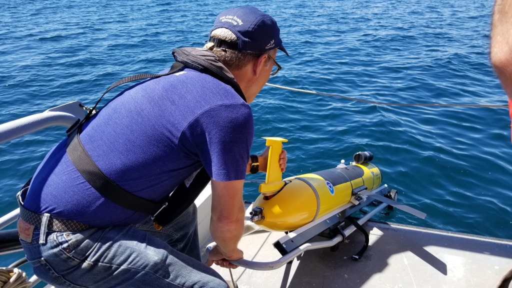
The collection and analysis of this data is a close collaboration between NOAA GLERL, CIGLR and partner institutions. CIGLR owns and operates the glider, and it is deployed using NOAA GLERL vessels. Data managers and researchers from both organizations are working together to make this data as useful and accessible as possible. This cooperative project, which has been funded by the Great Lakes Observing System (GLOS; a part of the IOOS program), aims to support science, public safety, and security through the use of unmanned systems (UxS).
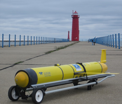
Glider Tech Specs
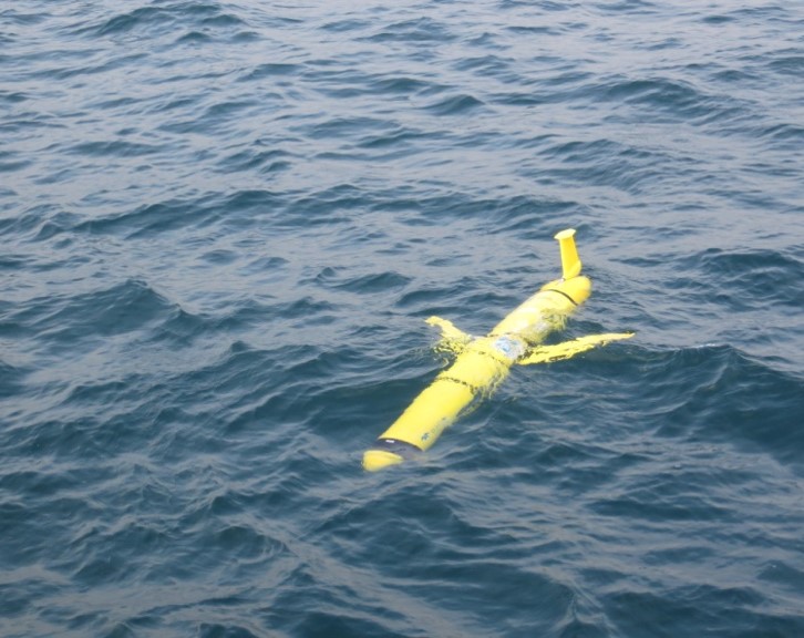
This glider is buoyancy-driven, meaning it controls its depth in the water by inflating and deflating a “bladder” that in turn makes it sink or float. It typically operates at around 30 meters (100 feet) below the lake surface, but can go as deep as 200 meters (650 feet) when needed. While the glider is able to work on it’s own, scientists wirelessly communicate with it regularly throughout its journey when it’s at the surface. It’s programmed to resurface regularly for check-ins, so we always know right where it is and we can even instruct it to change its mission path if necessary. It may only travel an average of 1 kilometer (0.6 miles) per hour, but its missions can last up to 60 days and provide us with amazing data sets to help answer questions about the Great Lakes ecosystem. Check out the video below from NOAA’s Ocean Service and visit this fact page for more on how the glider works.
The importance of data collection
With every deployment, the glider measures the water’s physical properties such as temperature, mineral content, pressure, and salinity. (Yes, even the Great Lakes have a tiny bit of salinity!) It also measures biological properties such as chlorophyll fluorescence and concentrations of dissolved organic matter, which indicate the region’s level of primary biological productivity (the amount of organic matter produced by phytoplankton in the water). Phytoplankton might be tiny, but their productivity is extremely important to the lakes’ ecosystems because it provides nutrients to the rest of the food web.
When you piece together all these day-to-day measurements, you can use them to study seasonal changes such as movement of the thermocline – or steep temperature gradient in the lake – which can impact the rate of biological activity in the spring and summer. The size and intensity of spring algal blooms and occasional “whiting events” (accumulations of calcium carbonate particles in the water due to increased biological productivity) are other examples of seasonal biological phenomena the glider can observe. The glider collects high-quality data efficiently and cost-effectively, day and night in all weather conditions, ultimately allowing us to collect more data in a shorter amount of time than is possible with traditional ship-based methods. The robust datasets it gives us advance our understanding of Great Lakes processes on short-term, seasonal, and annual timescales — and lay a foundation for observing changes in the lakes over several decades.
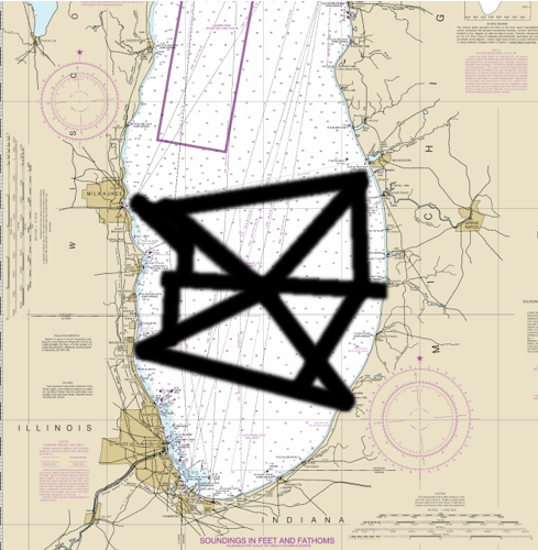
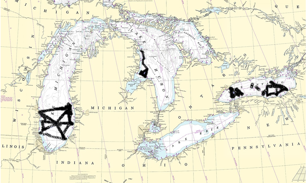
Glider paths shown on the maps include all deployment from 2012-2019. These paths expand observations collected by Federal and University research vessels in the same regions of the Great Lakes, through the use of other tools, such as NOAA GLERL’s Plankton Survey System (PSS) and Multiple Opening and Closing Net and Environmental Sampling System (MOCNESS). It is important to have a long period of observations from many types of collection across the lakes to better understand how things like water temperature at different depths, inputs from rivers, and seasonal changes to other characteristics of the water affect the ecosystem.This information is useful in understanding the impacts of invasive species, harmful algal blooms, and our changing climate.
Future deployments and collaboration
Planning is currently underway for future missions in the Great Lakes and potential applications for the glider’s wide variety of data. The glider will also be used this year on Lake Michigan for research and observations during the 2020 Cooperative Science and Monitoring Initiative (CSMI), a binational effort to coordinate science and monitoring activities in one of the five Great Lakes each year. This year’s CSMI research will likely use the glider to gain a better understanding of water quality in the lake’s nearshore regions – the area in the water from where waves begin to break, up to the lowest water point on the beach. With great partners like CIGLR and GLOS, the future is bright for NOAA’s underwater glider explorations.
