NOAA Great Lakes Environmental Research Laboratory

The latest news and information about NOAA research in and around the Great Lakes


Leave a comment

NOAA GLERL at 50: Half a century of Great Lakes science in service to society

Throughout 2024, NOAA’s Great Lakes Environmental Research Laboratory (GLERL) proudly celebrates its 50th anniversary!

NOAA GLERL is one of ten Federal research laboratories in the Oceanic and Atmospheric Research line office of NOAA. Designated on April 25, 1974, GLERL was established to provide a focus for NOAA’s environmental and ecosystem research in the Laurentian Great Lakes. The original GLERL was formed by merging staff from the Limnology and Computer Divisions of the Lake Survey Center of NOAA’s National Ocean Service with the staff of the International Field Year for the Great Lakes Office.

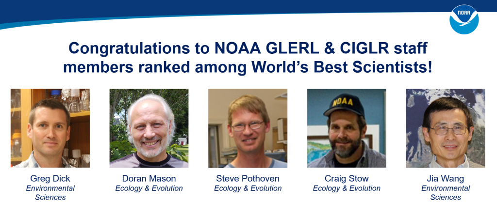
GLERL has made many important scientific contributions to the understanding and management of the Great Lakes and other coastal ecosystems. GLERL scientists regularly engage with academic, state, federal, and international partners. GLERL research provides information and services to support decisions that affect the environment, recreation, public health and safety, and the economy of the Great Lakes and coastal marine environments.

The Early Years

Algal blooms caused by excess nutrients were one of the major environmental issues in the 1970s, and a GLERL-developed phosphorus model was used by the International Joint Commission to determine loading limits. By 1980, the laboratory had expanded to include a major research effort on the cycling of sediment particles and associated toxic organics, which were recognized in the Great Lakes Water Quality Agreement as a major environmental problem. GLERL scientists led some of the early work in identifying and evaluating processes affecting the deposition and cycling of contaminants in the lakes. This work showed that the sediment zone is a major repository for contaminants and also a major source for recycling contaminants to the water column and food web. A Great Lakes oil spill model was put into operational use and successfully predicted the drift of an abandoned ship.

Aerial view of a harmful algal bloom on Lake Erie.

GLERL staff worked cooperatively with other agencies to develop research projects focused on major environmental issues in keeping with NOAA’’s mission and goals. GLERL’s water resources research focus was expanded to include the impacts of climate change on the Great Lakes, which has led to GLERL’s participation in the national Water Resources Forecasting Program. GLERL’s scientific expertise on the movement and cycling of sediment particles, and circulation measurements and modeling, has led to several large joint research programs with the U.S. Environmental Protection Agency to develop contaminant mass balance models for selected areas: the Upper Great Lakes connecting channels, Green Bay, and Lake Michigan. Also during this time, microcinematography was used to understand zooplankton behavior and predation.

1980s

Facilities and the Cooperative Institute for Great Lakes Research

In 1987, GLERL moved to a new facility in northeast Ann Arbor. This permitted consolidation of laboratories and marine instrumentation space for the first time. The Cooperative Institute for Limnology and Ecosystems Research (CILER), now known as the Cooperative Institute for Great Lakes Research (CIGLR), was established in 1989 in an agreement between NOAA, the University of Michigan, and Michigan State University.

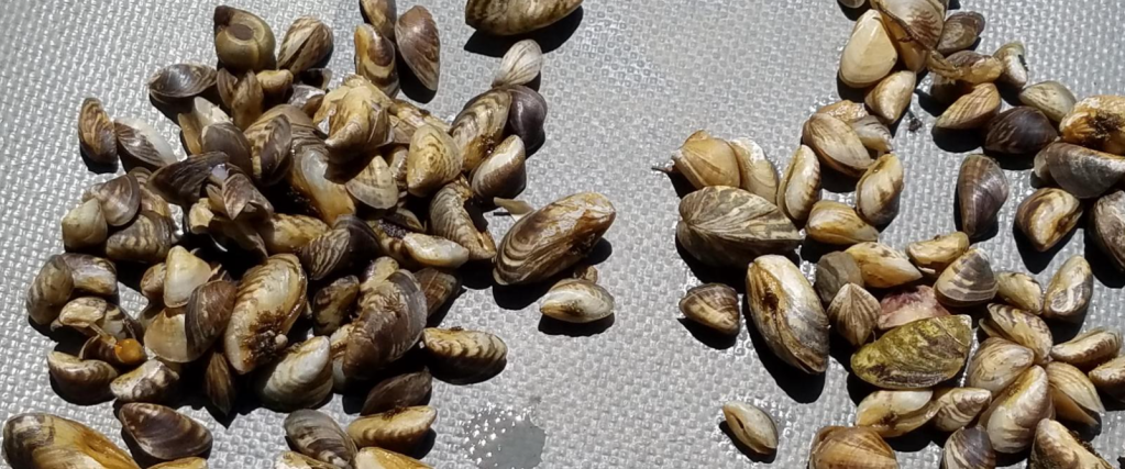
Research on Invasive Species

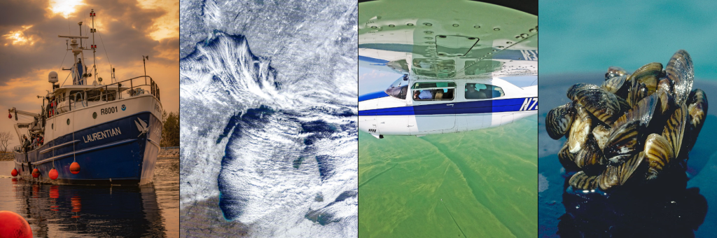
In 1989, GLERL launched a small research project on nonindigenous species. Research started with the ecosystem impacts of Bythotrephes, the “spiny water flea,” which had spread through most of the Great Lakes. However, with the discovery of Zebra mussels (Dreissena polymorpha) in Lake St. Clair, and the passage of the Nonindigenous Aquatic Nuisance Prevention and Control Act of 1990, GLERL was tasked with developing a major program on nonindigenous species, focusing on the ecosystem and environmental effects of the Zebra mussel. Through this program, GLERL scientists discovered the dramatic decline of the important, native amphipod Diporeia, first noted in Lake Michigan in the early 1990s. The ramifications of the Diporeia decline have been far reaching, affecting a series of ecologically and economically important fish.

1990s

Lake Michigan Field Station

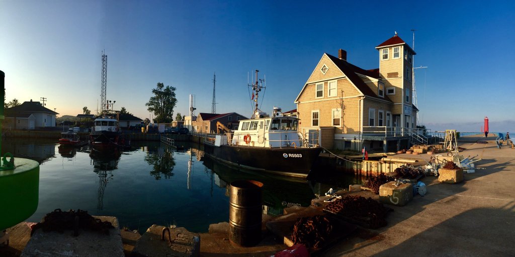
In 1990, GLERL assumed ownership of the former Coast Guard base at Muskegon, Michigan on the south side of the channel between Muskegon Lake and Lake Michigan. The site includes three buildings and research vessel dockage next to the main building. The U.S. Coast Guard established the Muskegon Life Saving Station in 1879, and a building was constructed at the current location in 1905. With its distinctive building architecture and prime location adjacent to public parks, the field station has become an icon of the Muskegon community. In 1995, the site was officially named the Lake Michigan Field Station.

NOAA GLERL’s Lake Michigan Field Station

Great Lakes CoastWatch Node

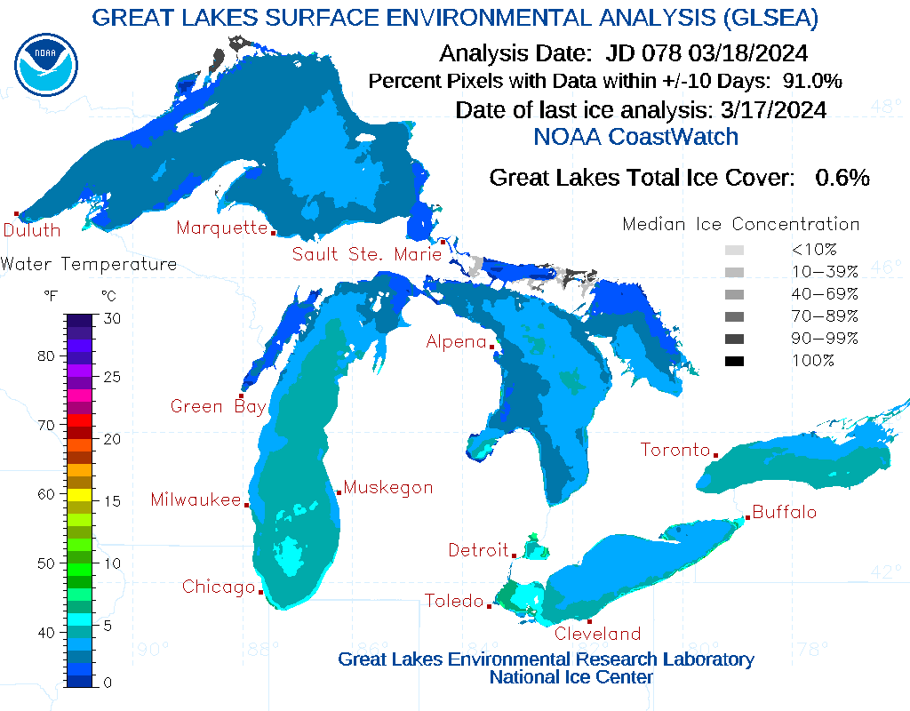
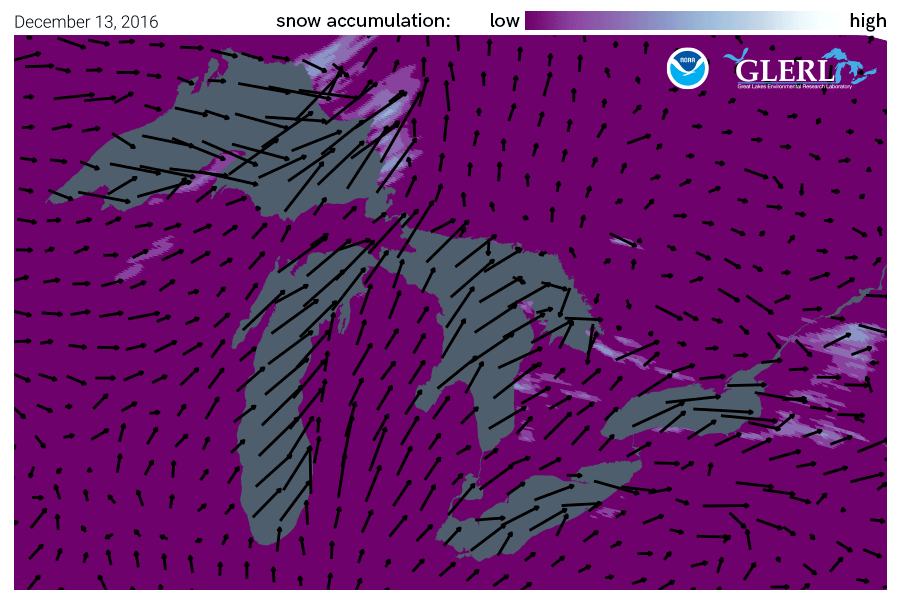
In 1990 the Great Lakes CoastWatch node was established as part of NOAA’s nationwide CoastWatch program, which helps people access and use global and regional satellite data for ocean and coastal applications. Great Lakes CoastWatch delivers environmental data and products for near real-time observation of the Great Lakes. It supports ecological forecasting, monitoring algal blooms, tracking sediment plumes, studying temperature effects on fish populations, and more.

GLERL hydrologist Deborah Lee utilizes GLERL’s early CoastWatch website in the 1990s. Today, Ms. Lee serves as the Director of NOAA GLERL.

Invasive mussel research

GLERL’s experimental work on invasive Dreissenid mussels expanded in the 1990s, focusing on feeding, growth, nutrient excretion, and other processes to help to explain mussels’ impacts on Great Lakes’ food webs. Now, the understanding gained from these studies is used by resource managers to inform decisions that support coastal infrastructure and economically important fisheries.

Invasive mussels from the floor of Lake Michigan

Episodic Events –Great Lakes Experiment

A large, interdisciplinary research program known as EEGLE (Episodic Events –Great Lakes Experiment) was led by GLERL scientists from 1997 to 2002. The project sought information on the importance of resuspended materials caused by spring storm events in Lake Michigan. This project served as the foundation for GLERL’s present-day Real-time Coastal Observation Network.

Expanding GLERL’s reach

In 1994, the first GLERL website went live. In 1998, GLERL became involved in the National Ocean Sciences Bowl Midwest Regional Competition for high school students, which continues to be an important annual outreach event hosted by the University of Michigan School for Environment and Sustainability and Michigan Sea Grant.

2000s

A new era of research vessels and facilities

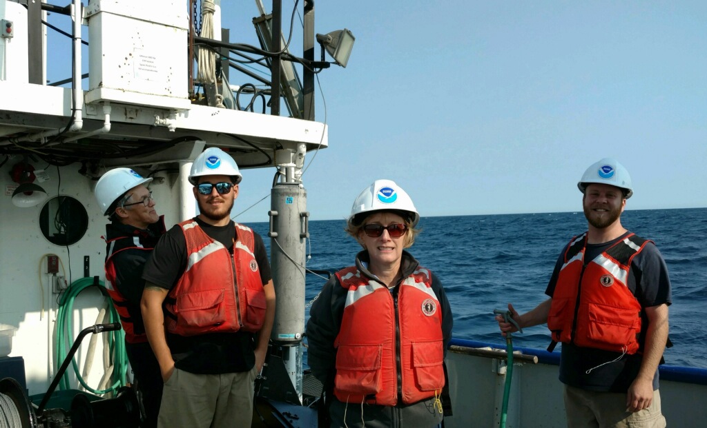
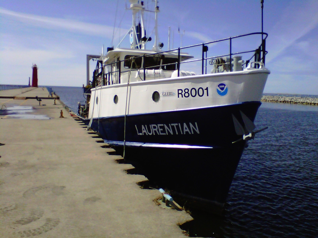
In 2002, GLERL acquired the research vessel Laurentian from the University of Michigan. The 80-foot vessel is part of a fleet that includes other large vessels and small boats. In 1999, staff at the Lake Michigan Field Station began retrofitting GLERL’s vessels to run on biofuels and achieved the goal of becoming a ‘petroleum-free’ fleet by 2006. Today, GLERL is helping other Federal agencies “green” their vessels through the Federal Green Fleet Working Group, formed in 2010.

R/V Laurentian docked in the Muskegon channel. March 16, 2010. Credit: NOAA.

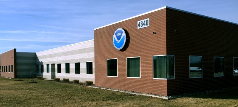
In late 2008, GLERL’s Ann Arbor facility moved across town to a new facility with much greater square footage and improved laboratory facilities, marine instrumentation storage and staging areas, and conference room space.

NOAA GLERL’s current Ann Arbor laboratory facility.

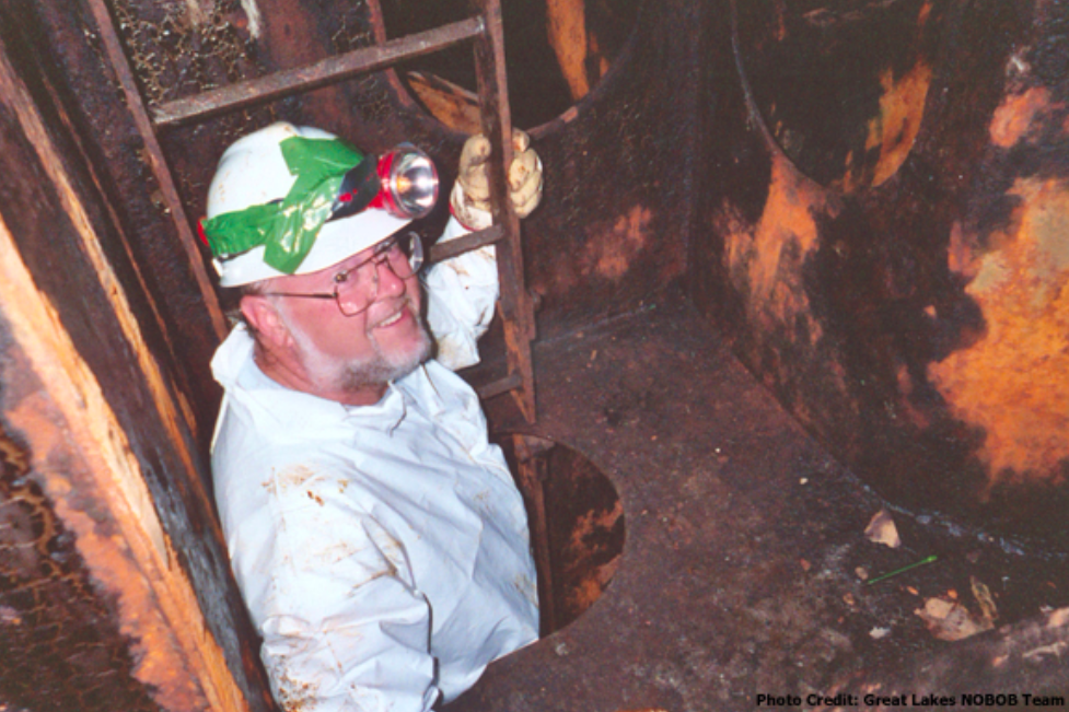
Supporting ballast water laws with invasive species research

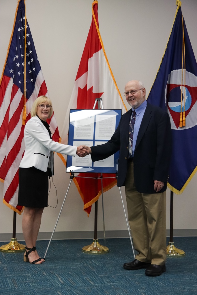
In the early to mid-2000s, GLERL’s invasive species research played an instrumental role in providing scientific evidence to support the improvement of ballast water management legislation for commercial shipping traffic entering the Great Lakes, known as the No-Ballast-On-Board (NOBOB) project. While management of ballasted foreign ships was relatively well established, essentially nothing was known about the extent and mechanisms of aquatic invasive species (AIS) introductions related to foreign ships that entered the Great Lakes under the NOBOB designation. 

GLERL scientist David Reid exiting a ballast water tank on a commercial ship while conducting research to better understand aquatic invasive species introductions in the Great Lakes.

The results of this project provided the core science needed to implement key ballast water management regulations in Canada and the U.S. to mitigate invasions from NOBOB vessels. Through GLERL’s scientific efforts and leadership of a world-class team of researchers, we have since seen a sharp decline in the introduction of new AIS into the Great Lakes basin – as reported in the State of the Great Lakes 2022 Report, no new species associated with ballast water have been introduced since 2006.

Leading Lake Erie research

GLERL led a large multi-agency experiment from 2005 to 2007 called the International Field Years on Lake Erie (IFYLE). The focus of this study was harmful algal blooms and hypoxia.

2010s

Great Lakes Restoration Initiative

Since 2010, nearly $5 billion has been invested in the Great Lakes region for restoration efforts through the Great Lakes Restoration Initiative (GLRI). The GLRI is a joint initiative of 16 federal agencies, led by the U.S. EPA, with the goal of restoring Great Lakes ecosystems.

To guide the work conducted under the GLRI, federal agencies created a comprehensive plan that prioritizes restoration and protection activities within five Focus Areas: Toxic Substances and Areas of Concern; Invasive Species; Nonpoint Source Pollution Impacts on Nearshore Health; Habitats and Species; and Foundations for Future Restoration Actions. NOAA has been allocated over $355 million in GLRI funds to accomplish restoration goals by generating ground-breaking science, creating and disseminating data products and services, and restoring critical habitats.

Cooperative Science and Monitoring Initiative (CSMI)

In the 2010s, GLERL became involved in the Cooperative Science and Monitoring Initiative (CSMI), a binational effort instituted under the Science Annex of the 2012 Great Lakes Water Quality Agreement to coordinate science and monitoring activities in one of the five Great Lakes each year. These efforts generate data and information for environmental management agencies. CSMI’s enhanced science and monitoring activities are conducted in response to priorities established by the Lake Partnerships of the Great Lakes Water Quality Agreement Lakewide Management Annex.

Two GLERL scientists conduct mussel research on the deck of a research vessel as part of CSMI.

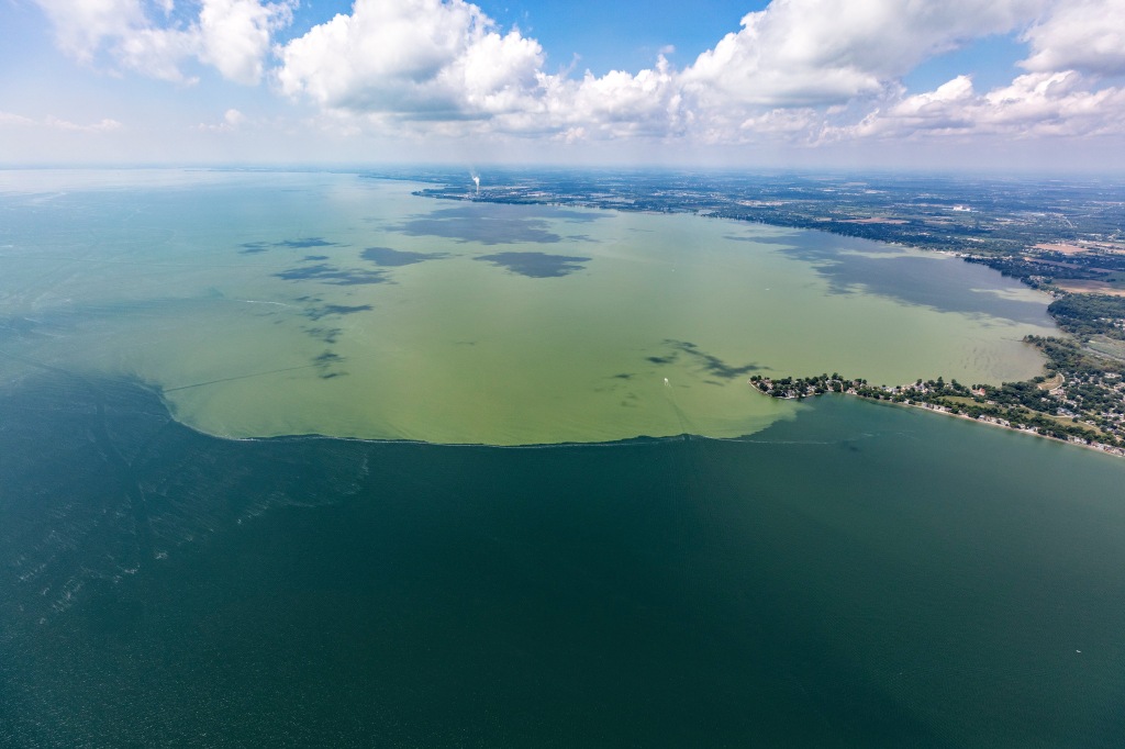
Toledo water crisis and resulting HAB research

In 2014, Toledo, Ohio officials issued a two-day ban on drinking and cooking with tap water for more than 400,000 residents due to toxins concentrations that exceeded the World Health Organizations guideline level for safe drinking water. These toxins were a result of an algal bloom that was occurring in western Lake Erie. The economic impact of a severe algal bloom season on Lake Erie has been estimated at $65 million. This event served as a wake-up call that harmful algal blooms (HABs) can be incredibly costly, have serious economic impacts, and can pose serious threats to human health, drinking water safety, and water-dependent businesses and activities. 

MODIS satellite image of Lake Erie showing harmful algal bloom. September 29, 2014. Credit: NOAA Great Lakes CoastWatch

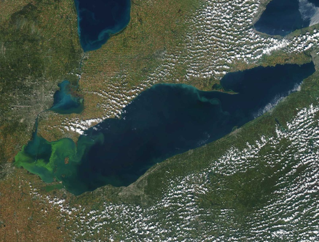
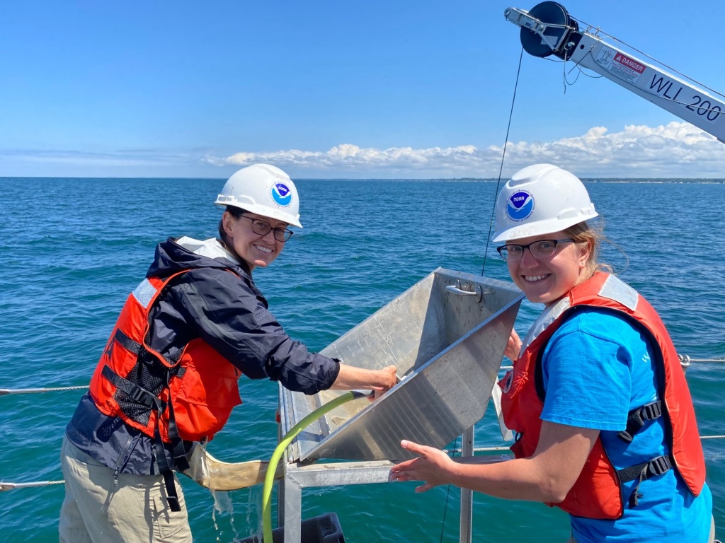
As such, this event underscored the importance of HAB monitoring, forecasting, and research. GLERL’s HABs research program uses an integrated approach to understand the environmental drivers of HABs and hypoxia to predict events. Using satellite images, remote sensing, buoys, a comprehensive monitoring program in Lake Erie, Saginaw Bay, and Lake Huron, and advanced genetic techniques, GLERL researchers work to understand the long and short-term seasonal dynamics of HABs and hypoxia. The data collected is used to inform forecast models used by key Great Lakes stakeholder groups, such as drinking water managers. 

GLERL’s Current and Future Directions

U.S. Coast Guard Great Lakes Center of Expertise for Oil Spill Response and Research

In 2021, GLERL was chosen as one of two worksites for the newly established United States Coast Guard (USCG) Great Lakes Center of Expertise (GLCOE) for Oil Spill Response and Research. GLERL experts are working to evaluate the General NOAA Operational Modeling Environment (GNOME) for the Great Lakes freshwater environment, identifying gaps for tracking oil spills such as freshwater conditions and ice effects, and developing strategies to address these gaps.

Much of GLERL’s oil spill modeling efforts focus on the Straits of Mackinac, shown here with a triangular model grid.

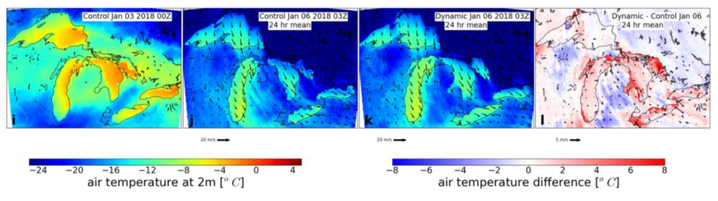
GLERL also incorporates its high-resolution Great Lakes Coastal Forecasting System (GLCFS) surface currents forecasts into the GNOME framework to evaluate and improve oil spill trajectories and location tracking to support potential response, rescue, and cleanup.

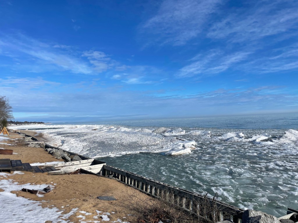
Our research addresses the potential impact of ice cover on oil spill trajectories including identifying efficient tracking for oil under ice, ice breaking, and wave-ice interactions. 

Today’s key research areas

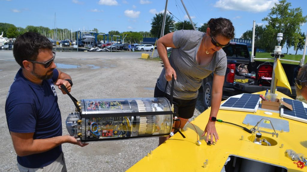
Today, GLERL research is carried out under three integrated science branches: Observing Systems and Advanced Technology, Ecosystem Dynamics, and Integrated Physical and Ecological Modeling and Forecasting. These three branches work together to collect the necessary information to develop and advance predictions of interconnected ecological and human systems in the Great Lakes. Current key research areas: 

  • Food web changes since the Zebra and Quagga mussel invasion
  • Climate change impacts
  • Development of coastal forecast systems
  • Dissemination of satellite imagery for environmental products development
  • Bioavailability of toxic organic chemicals
  • Using eDNA and ‘omics to predict impacts of climate change and invasive species on the microbial food web and enhance our ability to predict and monitor HABs
Collage of four photos showing the R/V Laurentian, a satellite photo of a lake effect snow event, a small plane conducting remote sensing research on algal blooms, and a cluster of invasive mussels.


Leave a comment

Early spring update on Great Lakes ice conditions

As we welcome the first day of spring, many people are curious how 2024’s Great Lakes ice cover data officially stacks up against previous years. But because ice cover typically peaks in late February or March, the Great Lakes ice season actually extends through much of the spring, into late April or early May. (In years with high ice cover, the northern areas of Lake Superior can still have ice as late as June!)

Although this year’s ice is lower than usual, NOAA GLERL will continue monitoring ice conditions through April as in past years. In the meantime, here’s a look at the numbers from this ice season so far.

Annual Maximum Ice Cover

Maximum ice cover on the Great Lakes peaked at 16% on January 22nd, which gives 2024 the fourth lowest annual maximum ice cover for the five lakes as a whole since records began in 1973. Additionally, Lake Huron set a new low record for its annual maximum ice cover, peaking at 22.6% on the same date. The previous record low for Lake Huron was 23.1% in 2012.

While Lake Superior’s ice cover was also the fourth lowest on record, this lake would have set a record low if not for a cold snap that brought its ice from 2.6% to 12% in a single day.

Average Ice Cover from January 1 to March 17

While it’s interesting to look at the numbers for maximum Great Lakes ice cover, Lake Superior’s one-day spike this year is a great example of how maximum ice values don’t tell the whole story. Looking at average ice throughout the season is more relevant for studying long term trends. In 2024, average Great Lakes ice cover from January 1st through March 17 set a record low. Average ice cover for this time period was 5.0%, breaking the previous record low of 5.5% set in 2012.  It’s most likely that once the season is over, the final seasonal average will rank among the lowest recorded.

Looking at the lakes individually, Lakes Superior, Michigan and Huron all broke their low records for average ice during this time period as well.

Current Conditions and Remainder of the Ice Season

Currently, Great Lakes ice cover is less than 1%. Cold air masses may still bring cooler temperatures to the region throughout early spring; however, air temperatures are unlikely to stay below freezing long enough to cause any notable increase in lake ice. As the northernmost lake, Lake Superior could see an uptick in shoreline ice if cold temperatures persist, but in the end this would not change the record-low status of this year’s ice cover.

Check back later this spring for a final assessment of the 2024 ice season!

Additional Resources

Learn more about NOAA GLERL’s ice cover research on our ice homepage.

Read this Q&A with GLERL Scientists on causes and impacts of this year’s low ice cover.

Explore Great Lakes Ice Cover Statistics on the NOAA Great Lakes CoastWatch Node.

NOAA Research story: Great Lakes ice cover reaches historic low

Climate.gov story: How warm winters and low ice may impact the Great Lakes


Leave a comment

NOAA GLERL Physical Scientist receives NOAA National Ocean Service Peer Recognition Award

NOAA GLERL Physical Scientist James Kessler recently received a NOAA National Ocean Service (NOS) Peer Recognition Award for outstanding day-to-day collaborative efforts involving crosscutting programmatic tasks that contributed to the accomplishments of the NOS mission. 

Peer Recognition “Rafting” Awards recognize coordination among NOS offices and provide NOS employees the opportunity to express their appreciation to another NOAA federal colleague that has helped them in some unique way. Congratulations, James, from all of us at NOAA GLERL!

The award nomination below describes James’ invaluable contributions to interagency collaborations between NOAA NOS, NOAA’s Office of Oceanic and Atmospheric Research (OAR), and the U.S. Coast Guard:

The Great Lakes contain 20 percent of the world’s surface freshwater supply and provide drinking water to over 40 million people. When a pollution event or natural disaster occurs, NOAA’s National Ocean Service Office of Response and Restoration (NOS/OR&R) is responsible for providing scientific analysis that supports decision makers recommendations of protecting life, property, and the environment. To accomplish this, OR&R often draws upon subject matter expertise from other parts of NOAA. This award is to recognize the outstanding professional performance of James Kessler (OAR/GLERL) when selected to participate and support two different OR&R events.

The first was an invitation for Mr. Kessler to participate in the U.S. Coast Guard (USCG) led oil spill exercise held in Roger’s City, MI on July 19, 2022. Showcasing NOAA’s role and ability to provide unified scientific support to the USCG during a spill emergency is imperative. The success of this public event with an audience of federal, state, and local emergency responders was a testament to the positive collaboration between NOS/OR&R and OAR. This particular exercise was significant as the USCG obtained approval to use a highly visible green dye in the water to mimic spilled oil in order to highlight environmental transport in the exercise area. Without previous emergency response experience, James Kessler provided detailed information on the hydrodynamic properties of Lake Huron with uncommon zeal and vitality. He developed an oil dispersion animation for the exercise scenario using the Great Lakes Operational Forecast System (GLOFS), ran the model during the event, and presented to over 100 attendees the GLOFS, High-Resolution Rapid Refresh (HRRR), and Global Forecast System (GFS) systems. Mr. Kessler displayed expert knowledge of NOAA Great Lakes capabilities including the Great Lakes Observing System (GLOS) and often brought in a representative to discuss observation systems and gaps in coverage with interested stakeholders.

The collaboration between OR&R and GLERL directly reflected NOS priorities of preparedness and risk reduction; as well as NOAA’s strategic priorities of communicating NOAA’s comprehensive observing systems and partnerships in the Great Lakes that improve data delivery and services to government and state agencies, as well as private industry stakeholders. In another example representing Mr. Kessler’s support, the newly established USCG Center of Expertise (COE) in partnership with the OR&R, funded a research project to test uncrewed aircraft systems’ (UAS) ability to collect and share data from a USCG vessel in an ice environment. James Kessler joined the project planning team in January and delivered time critical analysis of current and historical ice data for the Great Lakes.

Mr. Kessler’s astute analysis of ice data archives between 1973-present and initiative to generate time series plots provided concrete information for project managers to shift the dates and location of the project to ensure proper ice conditions. As a result, the field deployment component of the project was moved from January 22 in Port Huron, to March 6 in Duluth, MN and directly led to the successful capture of a USCG vessel breaking fresh ice and completion of the first field experiment funded by the COE. The successful outcome of this project also led to defining protocols for data sharing between USCG and NOAA that will vastly improve product support for pollution spills and disaster responses nationwide. While in the field, Mr. Kessler’s charisma was noted on a daily basis by USCG SES and earned him a deep sense of respect by all within the project team. His exceptional professional knowledge, enthusiasm, and dedication to mission contributed significantly and was the motivating force to keep collaborative efforts between NOS/OR&R, GLERL, and USCG moving forward.


Leave a comment

Q&A with NOAA scientists: Causes and impacts of 2024’s historically low Great Lakes ice cover

Many people have questions about the historically low Great Lakes ice cover this winter, and we’ve got answers! NOAA GLERL’s Bryan Mroczka (Physical Scientist) and Andrea Vander Woude (Integrated Physical and Ecological Modeling and Forecasting Branch Chief) answer the following frequently asked questions regarding the causes and impacts of this year’s low ice cover.

What’s driving the lack of ice? Is El Niño involved somehow?

The long-term trend shows a decline in ice cover in the Great Lakes region over the past several decades. Ice cover has been decreasing by approximately 5 percent per decade, for a 25 percent total decrease between 1973 and 2023. In addition, the length of the Great Lakes ice season has decreased by approximately 27 days on average over the same period.

Annual maximum ice cover on the Great Lakes, 1973-2023.

Factors that drive the lack of ice are climatic variables such as the El Niño-Southern Oscillation (ENSO) along the Equatorial Pacific in addition to other global oceanic oscillations. These atmospheric patterns in the ocean influence weather patterns in the Great Lakes, driving the climatic response of the lakes. Increases in air temperatures are responsible for the lack of ice in addition to the “heat memory” of the lakes as they retain heat from the summer season temperatures. 

While El Niño may have exacerbated the extreme low ice seen this year, the increased frequency of low ice years across the lakes is tied to generally warmer winter conditions, defined by fewer and generally shorter intrusion of arctic air into the region. While much of the Continental U.S. has seen a warming trend during the winter months, the upper Midwest/Great Lakes have seen some of the most dramatic warming.

Color-coded chart showing maximum annual ice cover percentage on the Great Lakes from 1973-2024. Bar colors indicate El Niño strength for each year, ranging from "very strong El Niño" to "El Niño not present"
This graph shows maximum ice concentration every year from 1973-2024, with color-coding to show El Niño strength each year. Note that 2024’s maximum ice cover of 16% is as of mid-February, and is subject to change if ice cover increases later in the season.

An important factor in a season’s ice potential across the Great Lakes is the weather patterns influencing the region during December. December is what we would consider a “priming” month, in which the first arctic air masses cool the lakes and begin the ice generation process within enclosed bays and along the shoreline. Recently, we have seen a multitude of Decembers exhibit above-average temperatures, including significantly above-average temperatures this winter in particular. The lack of early season cold air, and resulting late start to the ice generation season makes later significant gains in ice concentration harder to achieve.

How does the lack of ice impact the Great Lakes ecosystem, as well as towns and cities on the lakes? 

Ice is an important element for the ecosystems, economy, and coastal resilience across the Great Lakes. Ice is a natural part of the Great Lakes yearly cycle and many animal species, from microbial to larger fauna, rely on the ice for protecting young and harboring eggs. The Great Lakes also see most of their significant storms and large wave events during the colder months of late fall through winter. The shorebound ice sheets act as an important buffer against these waves, protecting the coast from erosion and damage to shoreline infrastructure. In years with very low ice, such as this one, the coast becomes more susceptible to the full onslaught of wave energy.

An ice shelf and pieces of floating ice line a residential seawall on Lake Huron on a sunny day.
Ice on the Lake Huron shoreline near Oscoda, MI on January 27, 2024. Credit: Clarice Farina

The economy of the Great Lakes can see negative and positive outcomes from a very low ice year. Two of the more important wintertime recreational sports in the Great Lakes include ice-fishing and snowmobiling. When the ice is scarce and thin, the ability to partake in ice-fishing is significantly reduced both spatially and temporally. When it comes to snowmobiling, warmer winters will generally result in more rain events compared to normal, as well as reduced snow cover and lower quality snow. 

One “silver lining” for the Great Lakes economy that may result from a low ice year, is a boost to the shipping industry. Low ice years are likely to extend the shipping season across the lakes, and may extend the season significantly if the locks are not hampered by significant ice. 

Is there still time for the ice to return before spring?

The ice season in the Great Lakes typically extends until the end of March, and the maximum ice cover for the year comes near the end of February to early March. The clear trend is one of decreasing ice, but it is still too early to determine how this year will ultimately compare to past years and the long term average. 

Winter is not close to being over, and periods of new ice generation are almost certain as we head through the next month. The longer term pattern into early March does suggest that a few bouts of arctic air will reach the Great Lakes, but similar to earlier portions of this winter, there does not appear to be a signal for any long term below average temperature events. The colder air events ahead are more likely to be short-lived (several days), and not long enough for significant gains in ice concentration. It is certainly possible that we’ll see the ice concentrations climb out of the current historic lows before the end of the month, but a major pattern shift (currently not in the forecast) would be required to drive ice concentrations out of below-normal realms for any of the lakes before the spring. 

How do low ice levels impact evaporation, water levels, and lake effect snow?

While Great Lakes water levels are generally lowest in the winter, most of the evaporation from the lakes actually happens in the fall. This is because evaporation is driven by a large difference between the air temperature and the water temperature, which happens in the fall when the air cools down but the water is still holding onto its summer heat. The graphic below illustrates the seasonal cycles that Great Lakes water levels undergo every year.

Graphic showing land in the background and water in the foreground, divided into four panels corresponding with the seasons. Text describes the water level changes throughout the year: Winter low, spring rise, summer peak, and fall decline.

As of right now, we are not seeing any significant impacts to water levels due to the lower ice. Water levels are essentially the same (within one inch) as the values we were seeing at this time last year, and running just a touch above the long term average. The U.S. Army Corps of Engineers is forecasting very little change in water levels for the next 6 months. The lakes are almost ice-free, but we are also not seeing any significant degree or duration of arctic air. Despite the lack of ice, the water temperatures are still cold – just a few degrees above freezing – so the generally small difference in water temperature and air temperature means that evaporation levels are kept in check.

One might assume that the lakes remaining ice-free might increase the amounts of lake effect snow, and this is possible given there is still a steady supply of colder air supportive of driving the lake effect. However, this winter, the lack of cold air arriving over the region has reduced the lake effect snow events, and promoted significant melting between events.

Why do NOAA GLERL’s ice records only go back to 1973?

The early 1970s is when we first had reliable satellite data with which to construct more accurate and complete datasets. Before the satellite era, information during the winter about ice concentration away from the shoreline was very limited. This is why we only use the 51-year dataset for our calculations, as this represents the highest quality data.

Learn more about this year’s low Great Lakes ice

Current and historical ice cover data from NOAA GLERL

NOAA Research: Great Lakes ice cover reaches historic low

Climate.gov: Ice coverage nearly nonexistent across the Great Lakes, as the historical peak approaches

Download images and graphics from this article on our 2024 ice Flickr album


Leave a comment

NOAA GLERL Deputy Director Jesse Feyen receives AMS STAC 2023 Coastal Environment Committee Outstanding Service Award

Congratulations to NOAA Great Lakes Environmental Research Laboratory Deputy Director Jesse Feyen on receiving an American Meteorological Society (AMS) award this week! Dr. Feyen was awarded the Scientific and Technological Activities Commission (STAC) 2023 Committee on Coastal Environment Outstanding Service Award.

NOAA GLERL Deputy Director Jesse Feyen (center) accepts his award with Yun Qian (Pacific Northwest National Laboratory, left) and Greg Dusek (NOAA National Ocean Service, right).

Remarks from the AMS awards ceremony:

Dr. Feyen is receiving this award for serving the AMS Committee on the Coastal Environment with exceptional distinction for 6 years. Dr. Feyen served as the committee chair from 2020 – 2023, a period which was obviously characterized by COVID and the challenges that COVID and virtual world posed to our ability to plan and host our symposium at the AMS Annual Meeting.

Under Jesse’s leadership the committee successfully adapted to the first ever fully virtual Annual Meeting, and the first ever Hybrid Annual Meeting. Through these challenges we saw a growth in the coastal symposium, both in the number and diversity of attendees, up to this year, where we had the greatest number of presentations and posters we have ever had at our symposium.

His leadership also resulted in a larger and more diverse committee – in career stage, background, race and gender – resulting in the outstanding committee which put together the symposium you are at today.

On top of all that, even after his tenure, Jesse has continued to serve and support the committee and been an invaluable resource to Yun and I as we stepped into the chair and vice-chair roles.

Congratulations, Deputy Director Feyen, from all of us at NOAA!


Leave a comment

Research Roundup: A look back at NOAA GLERL’s top science in 2023

From flood forecasting to winter buoys, 2023 has been a year full of innovative Great Lakes research at NOAA’s Great Lakes Environmental Research Laboratory (GLERL). As we get ready to ring in 2024, here’s a roundup of our top research stories throughout the year!

Robots give NOAA a peek under the ice of the Great Lakes

For a long time now, scientists have wanted to know more about what happens under the ice of the Great Lakes each winter, but getting the data has always been extremely challenging or almost impossible in this region. Over the last few years, NOAA GLERL has been working to develop new tools that may provide a fresh glimpse into the season. Read more

A small yellow Spotter buoy rests on the sand-covered ice after being washed ashore by winter waves. Credit: Russ Miller, CIGLR

Failing Upwards: Developing an Autonomous Surface Vehicle to Advance ‘Omics Research

For engineers and scientists, sometimes failure means progress. On August 5, 2023, scientists from NOAA GLERL, NOAA’s Atlantic Oceanographic and Meteorological Laboratory (AOML), and the Monterey Bay Aquarium Research Institute (MBARI) watched as a new solar powered surface vehicle, the SeaTrac, sailed off across the Great Lakes. Read more

NOAA GLERL engineer Kyle Beadle (left) and scientist Reagan Errera load a Third Generation Environmental Sample Processor into a SeaTrac autonomous surface vehicle in order to study the Lake Erie harmful algal bloom using ‘omics technology.

Close to HOMES – How GLERL’s Great Lakes expertise helps combat flooding in the Lake Champlain-Richelieu River Basin

In the world of NOAA, some of the most significant scientific advancements come as a response to natural disasters. Over the past decade, NOAA GLERL has been working with international partners to develop new tools to mitigate flooding on the Lake Champlain-Richelieu River basin. Read more

Satellite photo of Lake Champlain by the European Space Agency’s Sentinel 2.

Personnel Highlights of 2023

2023 was also a year full of accomplishments and recognition for GLERL’s leadership, scientists, and alumni. Congratulations to these members of the NOAA GLERL family!

GLERL Director Deborah Lee receives credential in sustainable infrastructure

This year, NOAA GLERL Director Deborah Lee was credentialed as an Envision Sustainability Professional by the Institute for Sustainable Infrastructure. She is the first NOAA employee to do so, and joins a group of more than 3400 engineering professionals nationwide with this credential. Read more

GLERL Scientist Ed Rutherford, former CIGLR technician David Wells, GLERL Director Deborah Lee, and GLERL technician Paul Glyshaw on the RV Laurentian while performing a spatial cruise sampling at Thunder Bay Marine Sanctuary in Lake Huron.

Former NOAA GLERL scientist recognized for career achievements in reducing Great Lakes aquatic invasive species introductions

During his career at NOAA GLERL, Dr. David Reid’s work played an instrumental role in providing scientific evidence to support the improvement of ballast water management legislation for commercial shipping traffic entering the Great Lakes. Through this work, we have seen a sharp decline in the introduction of new AIS into the Great Lakes basin and a heightened awareness of the impacts that invasive species can have on our ecological, economic, and cultural resources. Read more

Former NOAA GLERL scientist Dave Reid shakes hands with NOAA GLERL Director Deborah Lee during a ceremony recognizing his contributions to invasive species research in the Great Lakes.

NOAA GLERL and CIGLR scientists ranked in World’s Best Scientists list

Several of our scientists were recognized on Research.com’s list of “World’s Best Scientists” for 2023! This ranking identifies and celebrates exceptional individual researchers who are having a significant impact on the research community. NOAA GLERL and Cooperative Institute for Great Lakes Research (CIGLR) scientists are listed in the categories of Ecology and Evolution and Environmental Sciences. Read more

Want to keep up with NOAA GLERL’s latest research and accomplishments in 2024? Follow us on Twitter, Instagram and Facebook to stay updated!


Leave a comment

Lake effect snow: What, why and how?

As fall comes to a close, those who live and work in the Great Lakes region are wondering what weather this winter has in store. An El Niño Advisory is currently in effect, which means El Niño conditions have developed and are expected to continue. So, what does that mean for the Great Lakes? Will we still see lake effect snow?

An El Niño shifts the odds towards warmer, drier weather across the region – but that certainly doesn’t mean no snow! Whether or not there’s an El Niño, lake effect snow events can and do occur in the Great Lakes every year. In fact, we’re already experiencing them this year in places like Buffalo, NY and western Michigan.

During El Niño winters, the polar jet stream tends to stay to the north of the Great Lakes region, while the Pacific jet stream remains across the southern U.S. With the Great Lakes positioned between the storm tracks, warmer and possibly drier conditions can develop during El Niño events.

What is lake effect snow?

In the Great Lakes region, hazardous winter weather often happens when cold air descends from the Arctic region. Lake effect snow is different from a low pressure snow storm in that it is a much more localized and sometimes very rapid and intense snow event. As a cold, dry air mass moves over the unfrozen and relatively warm waters of the Great Lakes, warmth and moisture from the lakes are transferred into the atmosphere. This moisture then gets dumped downwind as snow.

Graphic via NOAA National Weather Service

Lake Effect Snow Can Be Dangerous

Lake effect snow storms can be very dangerous. For example, 13 people were killed by a storm that took place November 17-19, 2014 in Buffalo, New York. During the storm, more than five  feet of snow fell over areas just east of Buffalo, with mere inches falling just a few miles away to the north. Not only were lives lost, but the storm disrupted travel and transportation, downed trees and damaged roofs, and caused widespread power outages. Improving lake effect snow forecasts is critical because of the many ways lake effect snow conditions affect commerce, recreation, and community safety. 

MODIS satellite image of a lake effect snow event in the Great Lakes, caused by extensive evaporation as cold air moves over the relatively warm lakes. November 20, 2014. Credit: NOAA Great Lakes CoastWatch.

Why is lake effect snow so hard to forecast?

There are a number of factors that make lake effect snow forecasting difficult. The widths of lake-effect snowfall bands are usually less than 3 miles — a very small width that makes them difficult to pinpoint in models. The types of field measurements scientists need to make forecasts better are also hard to come by, especially in the winter!  We would like to take frequent lake temperature and lake ice measurements, but that is difficult to do during the winter, as conditions are too rough and dangerous for most research vessels and buoys. (However, NOAA is making progress towards expanding our Great Lakes winter observation capabilities!)

Satellite measurements can also be hard to come by, as the Great Lakes region is notoriously cloudy in the winter. It’s not uncommon to go for over a week without usable imagery.

Lake Effect Snow animation: This mid-December 2016 lake effect snow event resulted in extremely heavy snow across Michigan, Ohio, upstate New York as well as the province of Ontario east of Lake Superior and Huron.

NOAA GLERL and CIGLR work to improve lake effect snow forecasting

Currently, NOAA Great Lakes operational models provide guidance for lake effect snow forecasts and scientists at NOAA GLERL and the Cooperative Institute for Great Lakes Research (CIGLR) are conducting studies to improve them. 

They use data from lake effect snow events in the past and compare how a new model performs relative to an existing model.  One way to improve forecast model predictions is through a model coupling approach, or linking two models so that they can communicate with each other. When they are linked, the models can share their outputs with each other and produce a better prediction in the end.

Research published by CIGLR, GLERL and other research partners, “Improvements to lake-effect snow forecasts using a one-way air-lake model coupling approach,” is part of a series of studies (see list below) that help to make lake effect snow forecasts better. This study takes a closer look at how rapid changes in Great Lakes temperatures and ice impact regional atmospheric conditions and lake-effect snow. Rapidly changing Great Lake surface conditions during lake effect snow events are not accounted for in existing operational weather forecast models. The scientists identified a new practical approach for how models communicate that does a better job of capturing rapidly cooling lake temperatures and ice formation. This research can result in improved forecasts of weather and lake conditions. The models connect and work together effectively and yet add very little computational cost. The advantage to this approach in an operational setting is that computational resources can be distributed across multiple systems.

Study model run: This panel of images shows model runs that looks at data from a lake effect snow event from January 2018 with and without the new type of model coupling. The image on the far right labeled Dynamic – Control Jan 06 shows the differences in air temperature (red = warmer, blue = colder) and wind (black arrows) when the models are coupled. The areas in color show how the new model coupling changed the model output considerably and improved the forecast.

Our lake effect snow research continues

Our lake effect modeling research is ongoing, and NOAA GLERL, CIGLR, NOAA NWS Detroit, the NOAA Global Systems Laboratory continue to address the complex challenges and our studies build upon each other to improve modeling of lake-effect snow events. A future focus will be on running the models on a smaller grid scale and continuing to work to improve temperature estimates as both are key to forecasting accuracy. 


Related news articles and blog posts: 

Improving Lake Effect Snow Forecasts

Improving lake effect snow forecasts by making models talk to each other

Related research papers: 

Fujisaki-Manome et al. (2022) Forecasting lake-/sea-effect snowstorms, advancement, and challenges

Fujisaki-Manome et al. (2020) Improvements to lake-effect snow forecasts using a one-way air-lake model coupling approach. 

Anderson et al. (2019) Ice Forecasting in the Next-Generation Great Lakes Operational Forecast System (GLOFS)

Fujisaki-Manome et al. (2017) Turbulent Heat Fluxes during an Extreme Lake-Effect Snow Event

Xue et al. (2016) Improving the Simulation of Large Lakes in Regional Climate Modeling: Two-Way Lake-Atmosphere Coupling with a 3D Hydrodynamic Model of the Great Lakes


Leave a comment

NOAA GLERL and CIGLR scientists ranked in World’s Best Scientists list

NOAA’s Great Lakes Environmental Research Laboratory (GLERL) is pleased to recognize that several of our scientists have recently been recognized on Research.com’s list of “World’s Best Scientists” for 2023. This ranking identifies and celebrates exceptional individual researchers who are having a significant impact on the research community. NOAA GLERL and Cooperative Institute for Great Lakes Research (CIGLR) scientists are listed in the categories of Ecology and Evolution and Environmental Sciences.

Ecology and Evolution

Environmental Sciences

Congratulations to these scientists for this well-deserved recognition!


Leave a comment

Reflecting on a year of recognitions: NOAA GLERL Director Deborah Lee Accepts 2022 ASCE President’s Medal, GLERL team members recognized with NOAA awards

As FY23 comes to a close, here’s a look back at several awards received by NOAA GLERL’s amazing leaders, scientists and administrators this year!

The American Society of Civil Engineers (ASCE) recently awarded NOAA GLERL Director Deborah Lee the 2022 ASCE President’s Medal for “her leadership of the Environmental and Water Resources Institute to provide for the technical, educational, and professional needs of its members, and to serve the public in the use, conservation, and protection of natural resources, and enhancement of human well-being.” Lee personally accepted the award at the ASCE Annual Business meeting in Anaheim, CA.

Left: Deborah Lee shakes hands with ASCE past president Dennis D. Truax.
Right: Lee stands with Dennis D. Truax and Thomas W. Smith while holding her award.

Deborah Lee accepts her award at the ASCE Annual Business meeting in October, 2022. Photo credit: Jason Dixson Photography

The American Society of Civil Engineers (ASCE) represents more than 150,000 members of the civil engineering profession in 177 countries. Founded in 1852, ASCE is the nation’s oldest engineering society. Lee served as the 2021 President of the ASCE’s Environmental & Water Resources Institute (EWRI), a technical source for environmental and water-related issues. During her time as EWRI President, Lee oversaw a number of initiatives related to sustainable water resources management, including career development, overseeing a number of technical and member services councils, and environmental issues. 

Congratulations, Director Lee!


Additionally, several GLERL employees and recent retirees were recently honored with awards from NOAA, NOAA’s Office of Oceanic and Atmospheric Research (OAR), and NOAA’s National Weather Service, and the ASCE Environmental and Water Resources Institute.

Mark Rowe, Bronze Award – For leadership in developing the Ocean, Coastal, and Great Lakes Acidification 2020-2029 Research Plan. The highest honor award granted by the Under Secretary of Commerce for Oceans and Atmosphere for superior performance.

Bryan Mroczka, National Weather Service Cline Award – Outreach – For developing a collaborative, multi-agency video series to transform public understanding of historical hurricane impacts for Tampa Bay communities. A National Cline award is the highest recognition the National Weather Service awards to a person and/or group.

Lauren Fry, 2023 Environmental & Water Resources Institute Award for Best Case Study – For Great Lakes Runoff Intercomparison Project Phase 3: Lake Erie (GRIP-E) Journal of Hydrologic Engineering, Volume 26 Issue 9, 2021

Andrea VanderWoude and Songzhi Liu – 2022 NOAA National Environmental Satellite, Data, and Information Service (NESDIS) Collaboration Award

Mike Ryan, NOAA Silver Sherman Award – The Silver Sherman Award recognizes NOAA employees who perform work above their normal requirements to help fulfill NOAA’s mission, achieve a milestone that contributes significantly or critically toward a particular program goal, or demonstrate leadership toward process improvement of a significant magnitude.

Margaret Lansing (retired), Distinguished Career Award – For exemplary expertise, innovation, and leadership in communication over a sustained period in science, service, and stewardship to the Great Lakes

Timothy Hunter (retired), Distinguished Career Award – For over 34 years of outstanding technical contributions and leadership leading to improved understanding and forecasts of Great Lakes hydrology

Gregory Lang (retired), Distinguished Career Award – For 40 years of outstanding technical support in transitioning research models to operations and superb customer service to Great Lakes stakeholders

Jesse Feyen – NOAA OAR EEO/Diversity Award as part of the EEO Advisory Committee

Nicole Rice – NOAA OAR EEO/Diversity Award as part of the OAR Diversity and Inclusion Advisory Committee (ODIAC) team

Rita WilliamsNOAA OAR EEO/Diversity Award as part of the EEO Advisory Committee

Congratulations to these GLERL staff on being recognized for their dedication to NOAA’s mission of science, service, and stewardship!


Leave a comment

Former NOAA GLERL scientist recognized for career achievements in reducing Great Lakes aquatic invasive species introductions

This week, NOAA GLERL and partners had the pleasure of formally recognizing Dr. David Reid, whose research on aquatic invasive species (AIS) has had significant positive impacts on the health of the Great Lakes. Recognizing this renowned former GLERL scientist and his important research serves as an exciting kickoff to the celebration of our laboratory’s 50th anniversary in 2024!

Dr. Reid’s work played an instrumental role in providing scientific evidence to support the improvement of ballast water management legislation for commercial shipping traffic entering the Great Lakes. Through Dr. Reid’s scientific efforts and leadership of a world-class team of researchers, we have seen a sharp decline in the introduction of new AIS into the Great Lakes basin and a heightened awareness of the impacts that invasive species can have on our ecological, economic, and cultural resources.

Left: NOAA GLERL Director Deborah Lee presents David Reid with a letter recognizing his significant career accomplishments in reducing aquatic invasive species in the Great Lakes. Right: David and Helaine Reid stand with Deborah Lee (NOAA GLERL) Ceci Weibert (Great Lakes Commission), and Heather Stirratt (International Joint Commission)

Beginning his tenure with NOAA GLERL in 1985 as a physical scientist, Dr. Reid has worked on a wide variety of projects that have provided substantial benefits to the greater Great Lakes research and management community.  By combing through hundreds of historic reports from a diversity of sources throughout his career, in the early 2000s he helped to create the first comprehensive database of bulk ship traffic cargo patterns (as a surrogate for ballast data) for the Great Lakes. This database served as a predecessor of National Ballast Information Clearinghouse as well as revealing links between ship cargo movement and AIS introductions. 

With almost no prior experience within the field, Dr. Reid helped to build a world-class research team to tackle one of the most significant challenges in invasion management in the Great Lakes, the NOBOB (No-Ballast-On-Board) challenge. While management of ballasted foreign ships was relatively well established, essentially nothing was known about the extent and mechanisms of AIS introductions related to foreign ships that entered the Great Lakes under the NOBOB designation. Under Dr. Reid’s leadership, a binational scientific research project was convened, engaging a diverse group of experts from NOAA’s government, university, and industry partners. 

David Reid exiting a ballast water tank on a commercial ship while conducting research to better understand aquatic invasive species introductions in the Great Lakes.

Helping to lead this team and secure funding support for over 6 years of study provided the core science needed to implement key ballast water management regulations in Canada (2006) and the U.S. to mitigate invasions from NOBOB vessels. Through his unwavering commitment to building consensus among U.S. and Canadian governments and stakeholders, Dr. Reid has made significant contributions to the development of ballast water management requirements in the Great Lakes St. Lawrence Seaway System – the most stringent in the world – to prevent aquatic invasions through marine and Great Lakes shipping. 

Dr. Reid also envisioned a ‘one stop shop’ website where Great Lakes researchers could share verified information on current and predicted AIS, which would allow researchers to avoid duplication of basic efforts and ‘get ahead of the curve’ in addressing new invasions. He envisioned this new database as a regional node in a distributed network of databases operating at local to international levels, playing a key role in both verifying and aggregating information at the regional scale. The Great Lakes Aquatic Nonindigenous Species Information System (GLANSIS – launched in 2003) has grown from that vision to now serve the AIS-related information needs of researchers, managers, educators and stakeholders throughout the region. 

David Reid stands with GLANSIS Manager Rochelle Sturtevant in front of a GLANSIS poster.

Dr. Reid’s tireless efforts to address the ballast water vector for the introduction of invasive species to the Great Lakes and his efforts to promote regional information sharing have borne fruit. As reported in the State of the Great Lakes 2022 Report (based on data synthesized by GLANSIS) no new species associated with ballast have been introduced since 2006. As concluded in the recent invasion analysis of Ricciardi and MacIsaac (2022): “To our knowledge, the 2006/2008 regulation is the only case of a policy intervention that is linked to a massive reduction of the invasion rate of a large aquatic ecosystem. Since the current regulations were implemented, the overall rate of discovery of new non-native species declined by 84.6% compared to the partial regulation period. No other equivalent period of time in the documented history of the Great Lakes basin since 1835 has had fewer invaders discovered than the period of 2007−2019…”

Dr. Reid’s own words on the impacts of his work.

Even in retirement, Dr. Reid has continued to work with the shipping management agencies to ensure the new regulations are working effectively. Now, he is being formally recognized by the Aquatic Nuisance Species Task Force, the Great Lakes St. Lawrence Seaway Development Corporation, the International Joint Commission, the Great Lakes Commission and the Great Lakes Fishery Commission for his tremendous accomplishments and many years of service towards protecting our Great Lakes.

The Great Lakes community sincerely thanks and congratulates you, Dr. Reid!